"Wheelerguy" (wheelerguy)
12/06/2016 at 05:15 • Filed to: Custom Race Tracks
 0
0
 11
11|
"Wheelerguy" (wheelerguy)
12/06/2016 at 05:15 • Filed to: Custom Race Tracks | 0
| 11 |
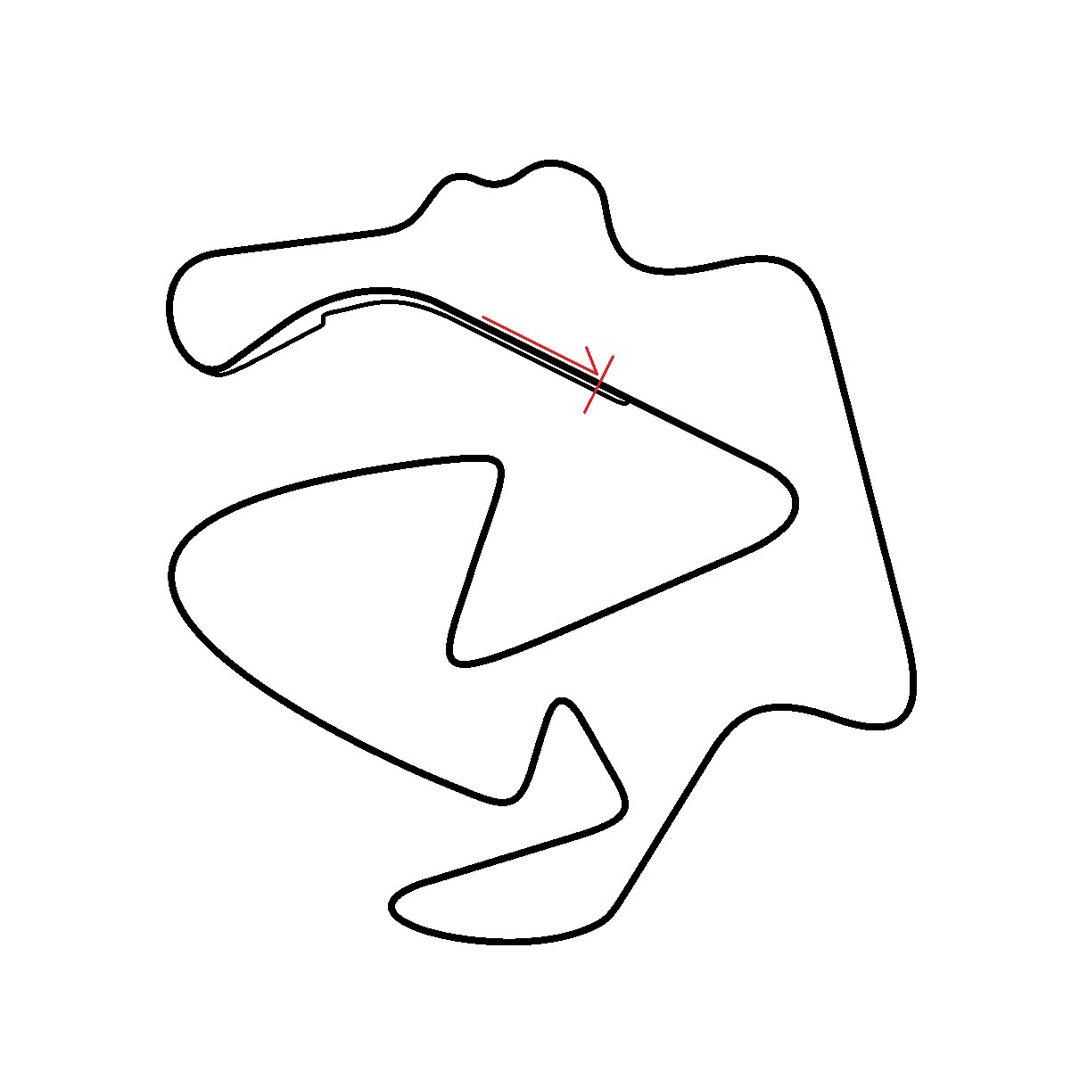
I got my centerpiece corner down, and I still have gobs of flow to spare. It’s also nice and balanced, I think, with fast corners, rhythm sections, slower bends, and weird-radius bits, plus all the straights you can ask for.
Now... which US state still doesn’t have a permanent race track? I’d like to plunk this layout there.
 E92M3
> Wheelerguy
E92M3
> Wheelerguy
12/06/2016 at 07:00 |
|
What the elevation change?
 Die-Trying
> E92M3
Die-Trying
> E92M3
12/06/2016 at 07:21 |
|
just outran me to the question......
|
Wheelerguy
> E92M3
12/06/2016 at 08:38 |
|
I... I... have got no idea.
Now, I can go and describe the track to you as vividly as I can in writing, but if I say that the track is in Chetwynd, Alberta in Canada, my descriptions could run into a brick wall in terms of accuracy.
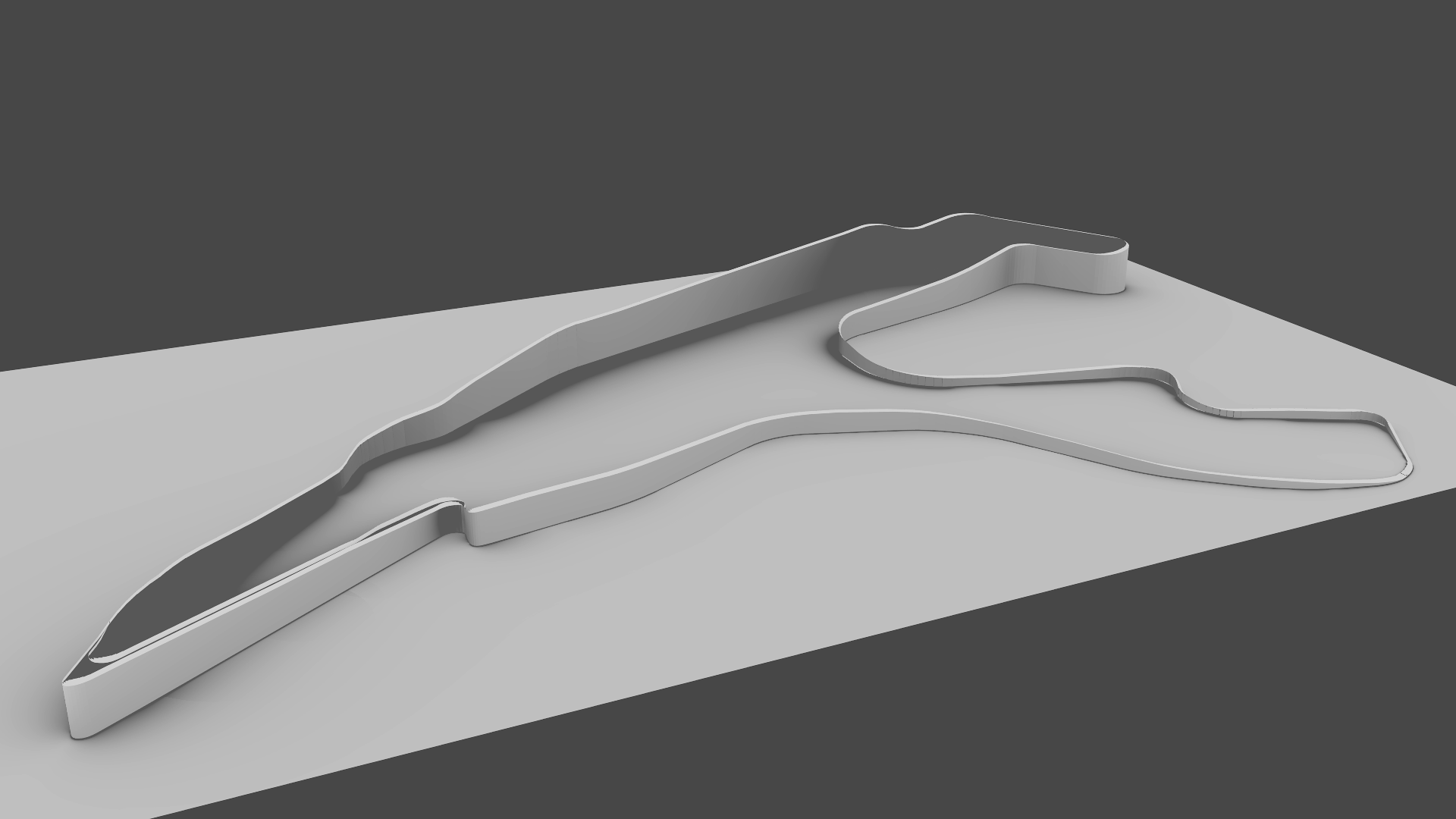
What I need, essentially, is a program or something that can put my line down a plot of land and make a quick render of what it will look like, kinda like this.
|
Wheelerguy
> Die-Trying
12/06/2016 at 08:40 |
|
I can go and describe the track to you as vividly as I can in writing, but if I say that the track is in Chetwynd, Alberta in Canada, my descriptions could run into a brick wall in terms of accuracy.
|
Die-Trying
> Wheelerguy
12/06/2016 at 08:58 |
|
no, see the track looks great, but when you see it only in a flat layout, its flat.
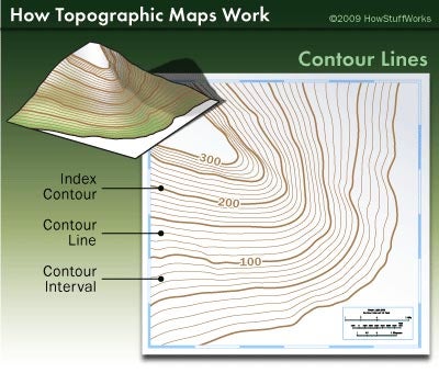
if you had some kind of indicator, kinda like a topographical map, that showed i have a big hill right here(maybe some green/blue circles?), and it leads to this ravine valley(maybe some red cirles?) you get an idea of the flow of the track.
that last pic with the cutaway is about right.
|
Wheelerguy
> Die-Trying
12/06/2016 at 09:00 |
|
I think I got it, but just in case... show me.
|
Die-Trying
> Wheelerguy
12/06/2016 at 09:30 |
|
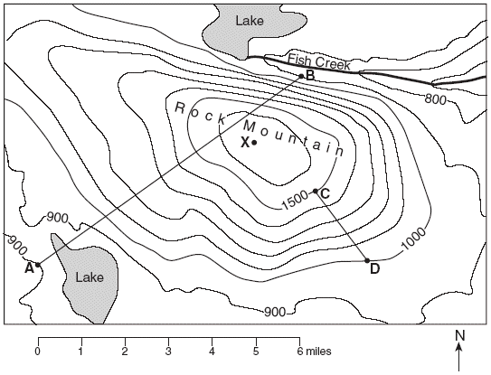
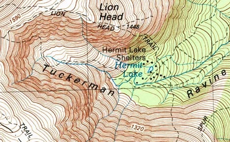
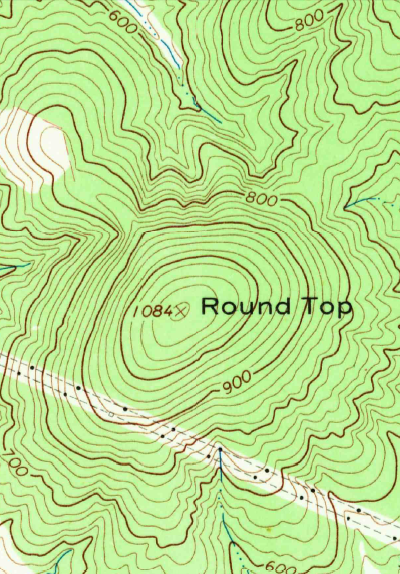
the first map is about ideal, its simple, and isnt so busy as to take your attention away from the track. the second two are actual maps that show, a ravine in the first one, and a hill on the second all the lines give you an idea of the shape of a hill or valley like this
but on your track, you could just show what is the flat section, and then show with some amoeba shapes, i have a hill here, and maybe an idea of how tall it is. no need to get crazy with the suveyor level OCD of a REAL topo map.
good looking track.
|
E92M3
> Wheelerguy
12/06/2016 at 09:32 |
|
Elevation makes or breaks a track. All the greatest tracks have extreme elevation changes. The Ring, Laguna Seca, Road Atlanta. The feeling of the suspension unloading as you go over a blind crest, is what makes adrenal glands happy.
|
Die-Trying
> Die-Trying
12/06/2016 at 09:36 |
|
also
and this other one
are ways of showing elevation
|
Wheelerguy
> Die-Trying
12/06/2016 at 09:45 |
|
good looking track.
Wow, thanks! And thanks for the tips, too. It’s very much a helpful thing to have.
And I think I kind of get the idea now, and I can set off from here.
|
Die-Trying
> Wheelerguy
12/06/2016 at 09:52 |
|
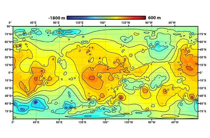
i found a good map, it is “Topographic map of Saturn satellite Titan” the important thing is, look how simple it is. and how it uses the color to show elevation. something to think about.