"pedal-force" (pedal-force)
10/27/2014 at 10:55 • Filed to: None
 1
1
 25
25|
"pedal-force" (pedal-force)
10/27/2014 at 10:55 • Filed to: None | 1
| 25 |
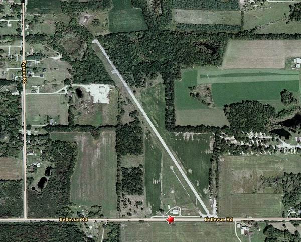
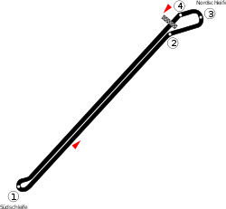
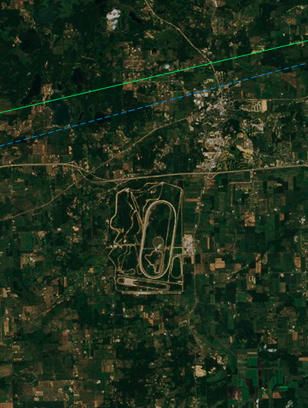
Flying from Philly to Chicago O'Hare a few weeks ago I flew over a cool looking track that I haven't been able to locate. It looked like some sort of test track. There was a skidpad looking area, a road course, some service roads, and a giant AVUS looking track. It was two huge straights connected by two circular turns (more like turn 1 at AVUS, just duplicated). I think I was over Michigan, but I don't know, I could have been in Canada. I was relatively near one of the Great Lakes, but I don't know which one. It was seemingly in the middle of nowhere.
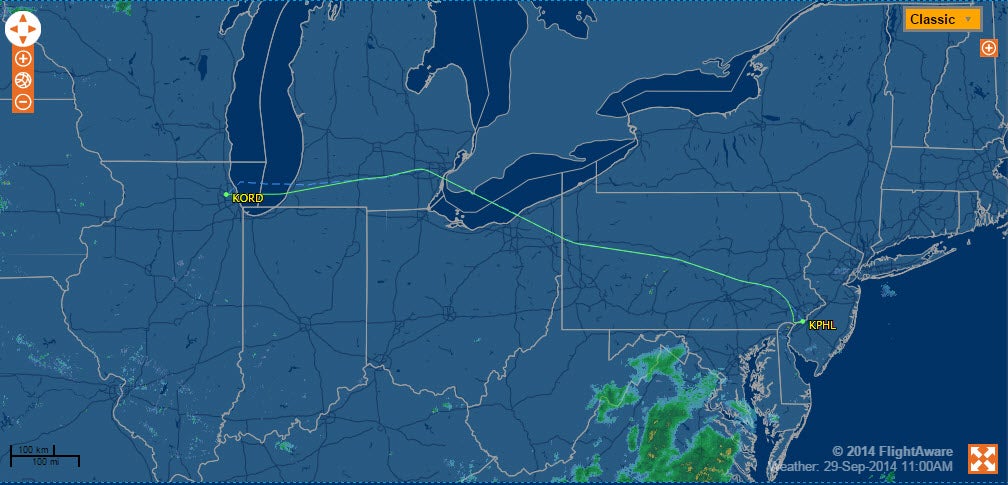
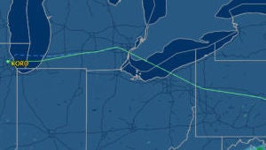
My flight path is below if that helps. It wasn't the normal path because of the fire at O'Hare. We went way north over Michigan.
Any ideas? It's driving me a little crazy.
 STREPITUS
> pedal-force
STREPITUS
> pedal-force
10/27/2014 at 11:00 |
|
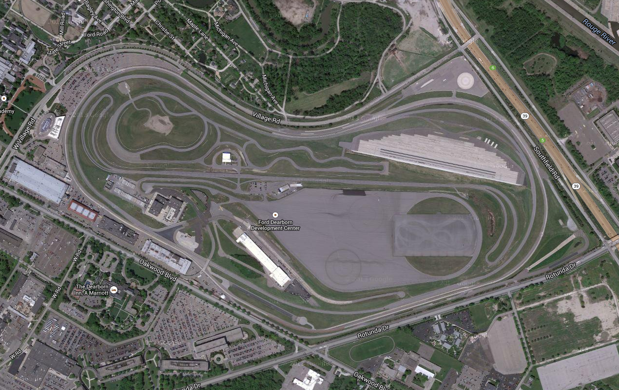
You flew over SE Michigan, could've been any of the Big 3's proving grounds. This is Ford's
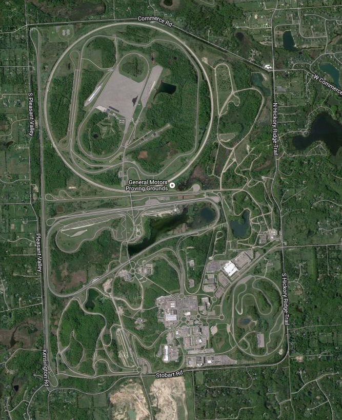
And GM's
And Chrysler's
All 3 are in your general flight path, and there are countless other proving grounds that have similar straightaways to your sketch in the area.
 Chris Clarke
> pedal-force
Chris Clarke
> pedal-force
10/27/2014 at 11:01 |
|
You can change the map type to satellite in flightaware. Might help you better locate landmarks along your route.
 Will with a W8 races an E30
> STREPITUS
Will with a W8 races an E30
> STREPITUS
10/27/2014 at 11:06 |
|
Don't forget Ford's Romeo proving ground:
https://www.google.com/maps/@42.84231…
|
pedal-force
> STREPITUS
10/27/2014 at 11:07 |
|
I checked all of those already, I don't think it was any of them. They were more remote than Ford's, Chrysler's doesn't have the right track type, and I feel like the high speed loop part was more pronounced than GM's, plus more remote.
|
pedal-force
> Chris Clarke
10/27/2014 at 11:08 |
|
Good idea, I'll try that.
edit: you can't zoom far enough to see anything. Just green. I need a way to overlay onto Google Maps so I can follow along at a low level.
 Cebu
> STREPITUS
Cebu
> STREPITUS
10/27/2014 at 11:08 |
|
Ford's seems closest to the description.
 Mason-Dixon
> pedal-force
Mason-Dixon
> pedal-force
10/27/2014 at 11:09 |
|
I fly that exact route about 12 times a year—I'll keep an eye out
|
pedal-force
> Mason-Dixon
10/27/2014 at 11:11 |
|
I think the problem is this isn't the normal route. It was messed up due to the fire. This is the normal route, much more southern, stays out of Michigan completely.
https://flightaware.com/live/flight/UA…
|
Will with a W8 races an E30
> pedal-force
10/27/2014 at 11:11 |
|
You would have flown right over Chrysler's if that map is correct.
|
pedal-force
> Cebu
10/27/2014 at 11:18 |
|
GM's actually looks the closest, but still not quite right. I think it was more rural and smaller. The high speed track dominated, the rest was kind of small.
 King Ginger, not writing for Business Insider
> pedal-force
King Ginger, not writing for Business Insider
> pedal-force
10/27/2014 at 11:30 |
|
Probably the long straight at Milford Proving Grounds?
|
Chris Clarke
> pedal-force
10/27/2014 at 11:32 |
|
That's odd, i can zoom way in.
|
pedal-force
> Chris Clarke
10/27/2014 at 11:37 |
|
Ah, you have premium satellite. Mine is just Earth, I don't get a satellite option. I guess you're an actual member. I'm just a free member.
|
Chris Clarke
> pedal-force
10/27/2014 at 11:40 |
|
send me a link to your flight
|
pedal-force
> Chris Clarke
10/27/2014 at 11:45 |
|
https://flightaware.com/live/flight/UA…
|
Chris Clarke
> pedal-force
10/27/2014 at 11:51 |
|
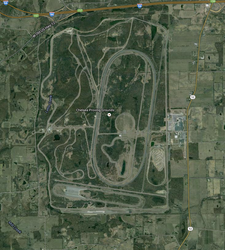
There's this one in Chelsea, MI.
|
Chris Clarke
> pedal-force
10/27/2014 at 11:55 |
|
You can overlay this in google earth. https://www.dropbox.com/s/xn0k1zx4lfhc…
 DocWalt
> pedal-force
DocWalt
> pedal-force
10/27/2014 at 12:08 |
|
Maybe PittRace / BeaveRun ? Looks like you were a bit too north for that though.
|
pedal-force
> Chris Clarke
10/27/2014 at 12:17 |
|
Cool, thanks. I don't have Google Earth at work, but I'll try at home. The one in Chelsea isn't it though, no long straight weird corners thing.
 2BWise
> pedal-force
2BWise
> pedal-force
10/27/2014 at 12:32 |
|
Maybe Ford's Romeo Proving Ground?
 Rock Bottom
> pedal-force
Rock Bottom
> pedal-force
10/27/2014 at 12:59 |
|
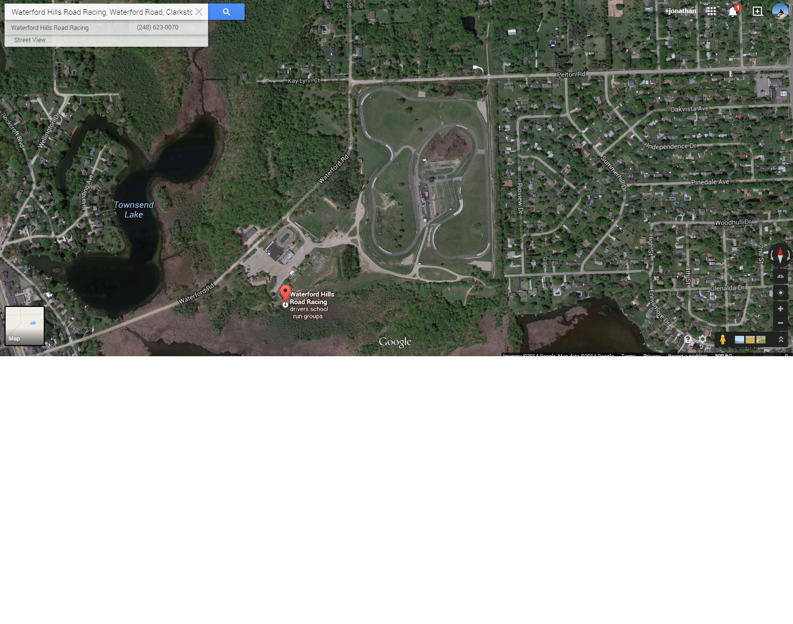
Waterford Hills?
|
Rock Bottom
> pedal-force
10/27/2014 at 13:02 |
|
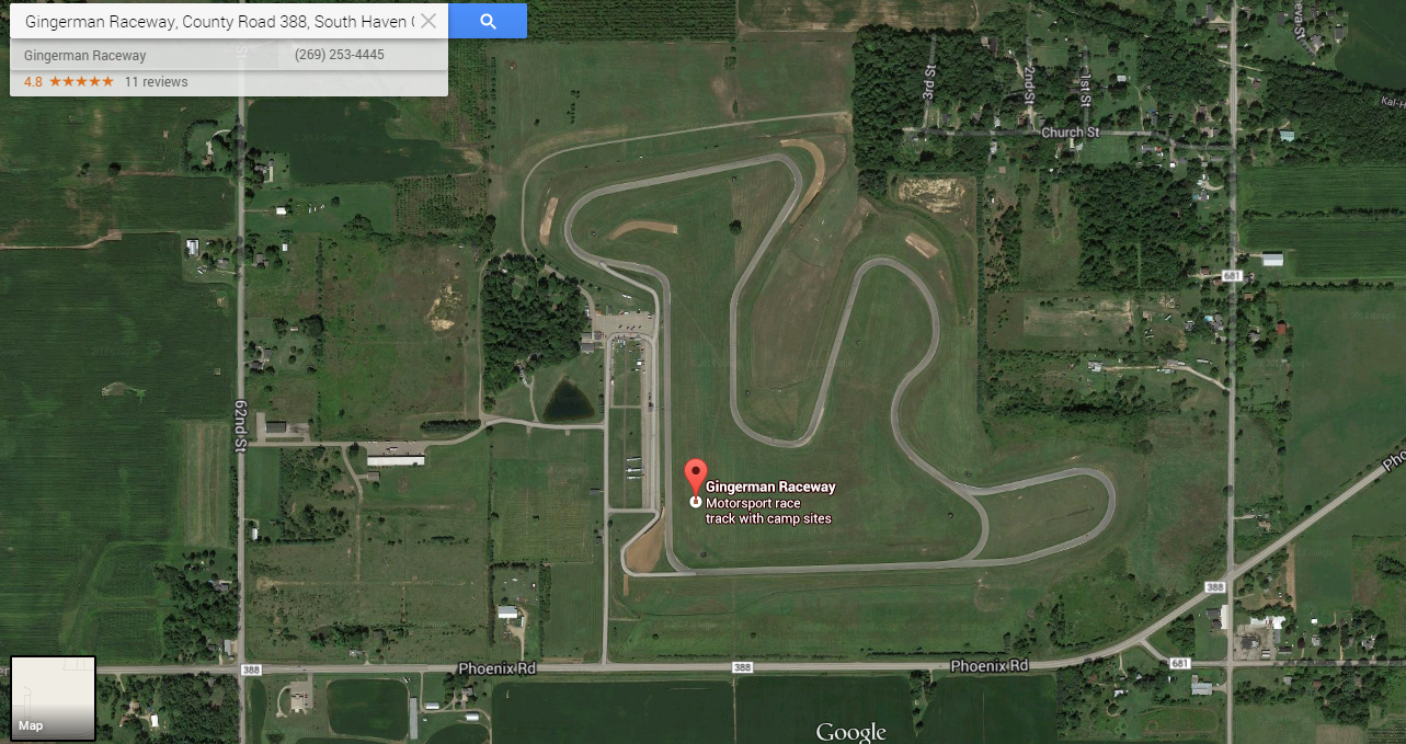
Maybe Gingerman, if it was in the South West corner of the state:
 You can tell a Finn but you can't tell him much
> pedal-force
You can tell a Finn but you can't tell him much
> pedal-force
10/27/2014 at 14:21 |
|
It definitely looks like the long straight at GM's Milford Proving Grounds, but the big circle is way more noticeable and there is no question when you see that.
Were you looking out the north or south side of the plane? Roughly how long into the flight and how long was the flight? If we can narrow it down to a short section of flight time and which side of the flight path it was on it would make things much easier.
|
pedal-force
> You can tell a Finn but you can't tell him much
10/27/2014 at 14:30 |
|
I was on the right side of the plane, so looking North of the path. I don't remember what part of the flight though, I was listening to podcasts and kind of zoned out. I feel like I saw water either right before or right after. It's possible we were even in that little section of Ohio, I didn't even consider that. It was pretty rural and desolate from what I remember, but I have a notoriously awful memory.
|
You can tell a Finn but you can't tell him much
> pedal-force
10/27/2014 at 16:37 |
|
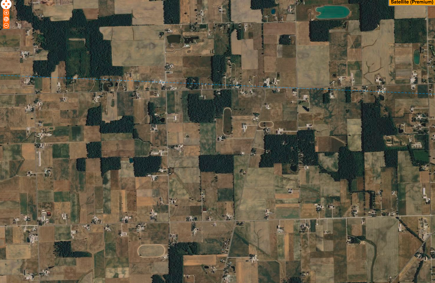
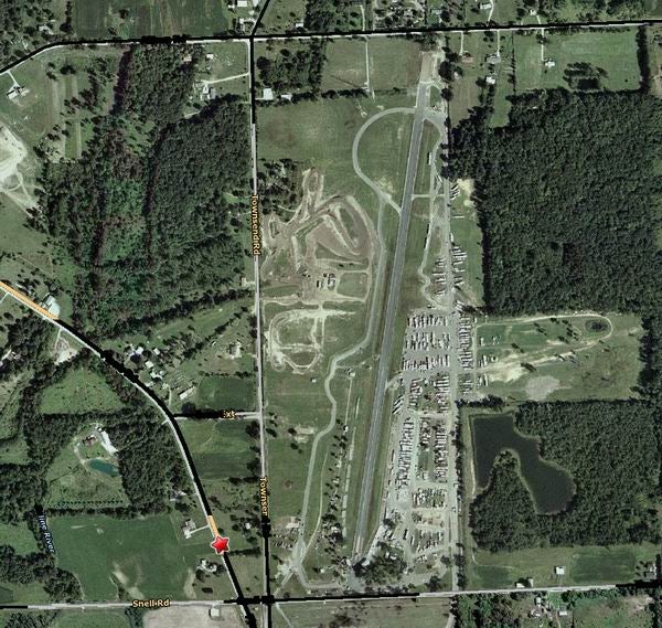
Maybe a dragstrip? Here is Milan Dragway (upper photo), but it looks like that would have been a ways south of your flight path.
This is Onandaga Dragway (2nd photo) which would have been north of your flight path, but maybe too far north.