 "sony1492" (sony1492)
09/25/2020 at 15:27 • Filed to: its on fire yo
 3
3
 3
3|
"sony1492" (sony1492)
09/25/2020 at 15:27 • Filed to: its on fire yo | 3
| 3 |
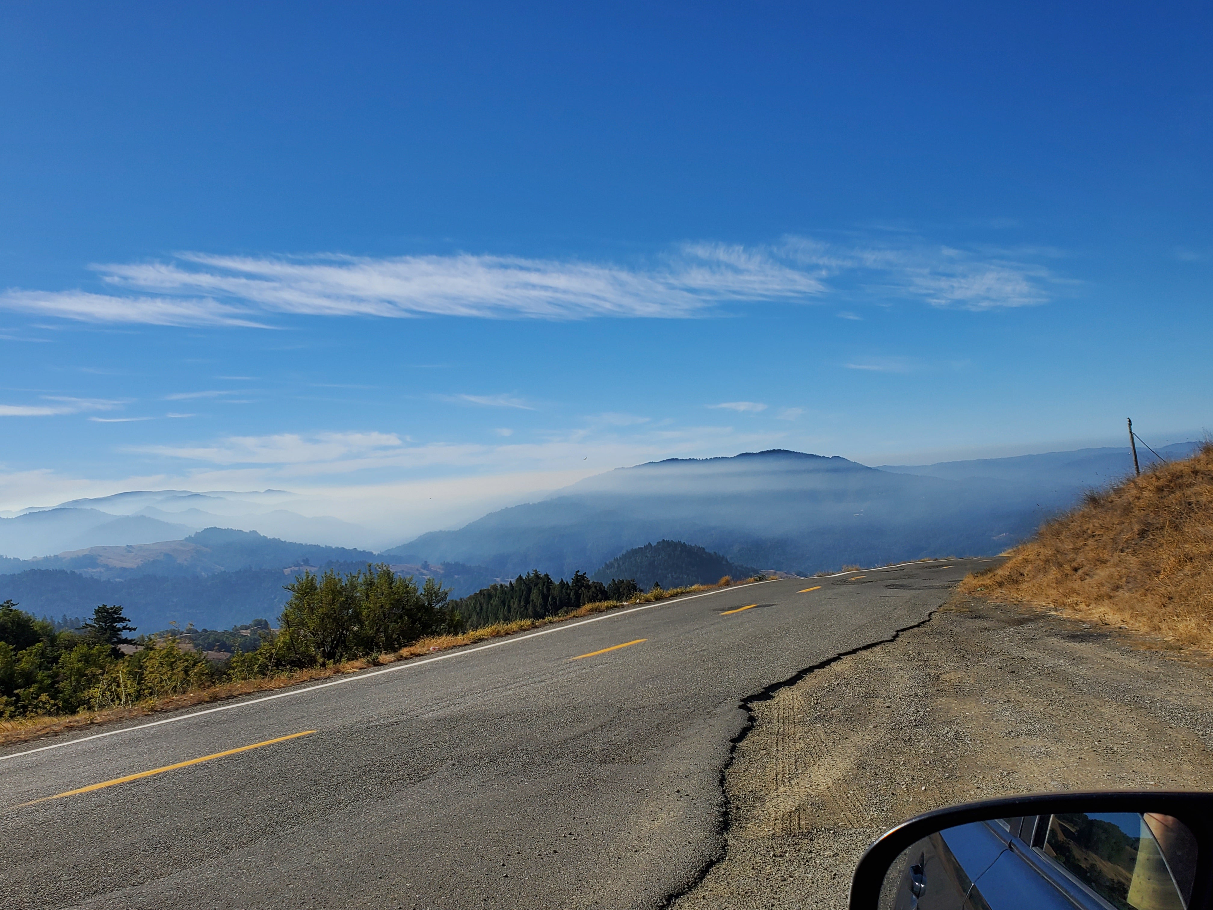

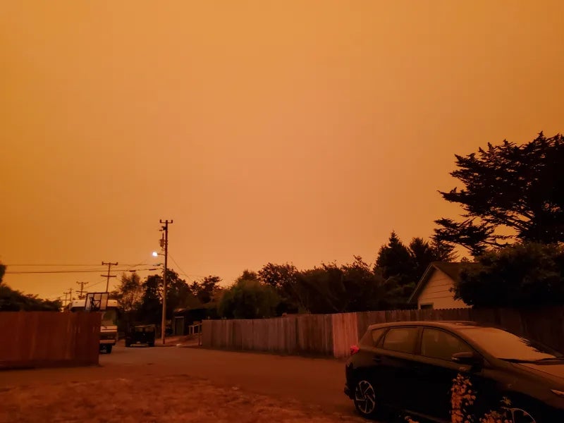
This about 20 miles inland 100 miles south of the Oregon border , currently the coast is clear. Still way better then a few weeks ago where the Oregon and Norcal looked like this:
 dieseldub
> sony1492
dieseldub
> sony1492
09/25/2020 at 16:13 |
|
Looks like one of the more recent active sections of the fire in the Trinitys up there is approaching highway 36. Winds are going to shift over the weekend, could start moving your direction some.
Stay on your toes, my friend.
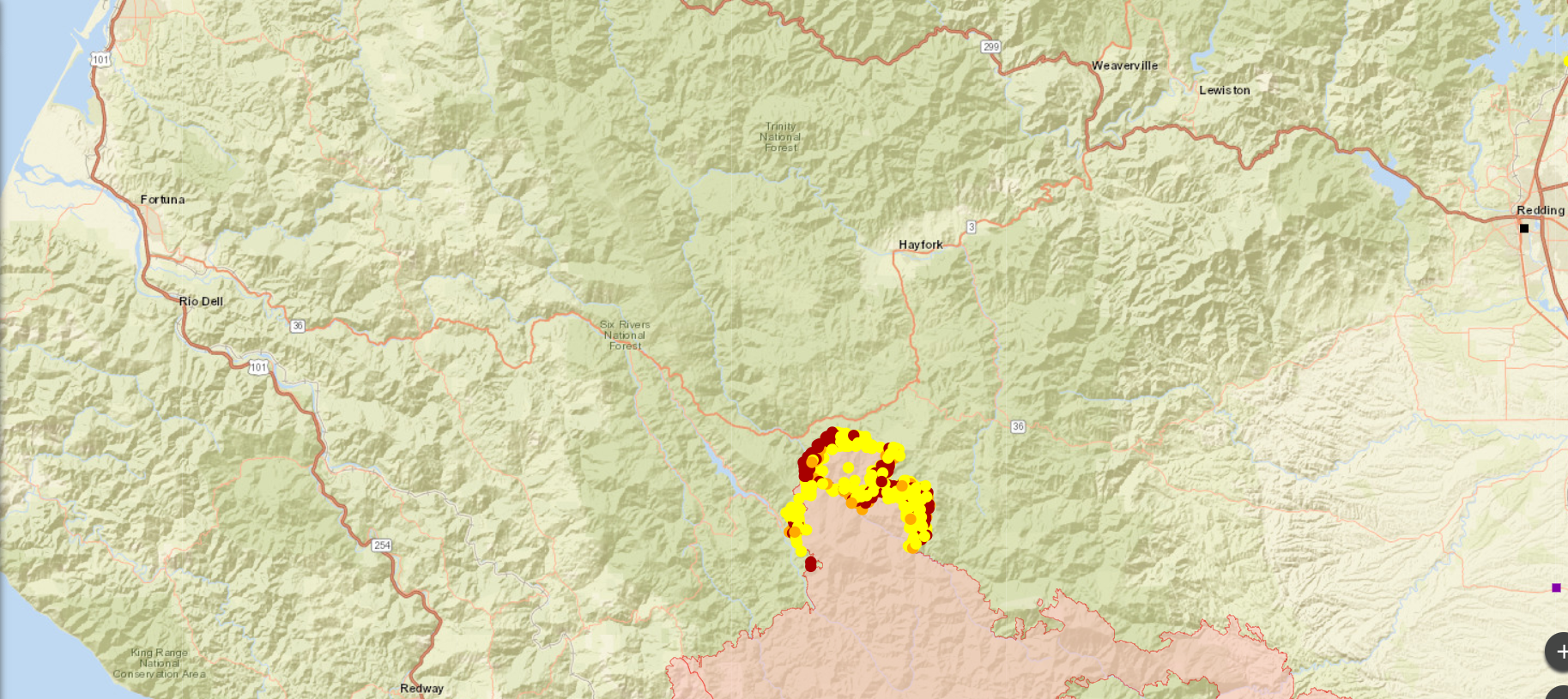
Use this link to keep an eye on it. This is satellite detection of where it’s spreading. It’s more realtime than what you’ll see on CalFire maps.
https://maps.nwcg.gov/sa/#/%3F/%3F/40.3089/-122.7754/9
 Turbineguy: Nom de Zoom
> dieseldub
Turbineguy: Nom de Zoom
> dieseldub
09/25/2020 at 16:35 |
|
Oppos looking out for other Oppos. Nice.
|
sony1492
> dieseldub
09/25/2020 at 16:41 |
|
Just was on a drive, family in the area is definitely ready for a moments notice though