 "If only EssExTee could be so grossly incandescent" (essextee)
11/04/2018 at 22:12 • Filed to: None
 0
0
 8
8|
"If only EssExTee could be so grossly incandescent" (essextee)
11/04/2018 at 22:12 • Filed to: None | 0
| 8 |
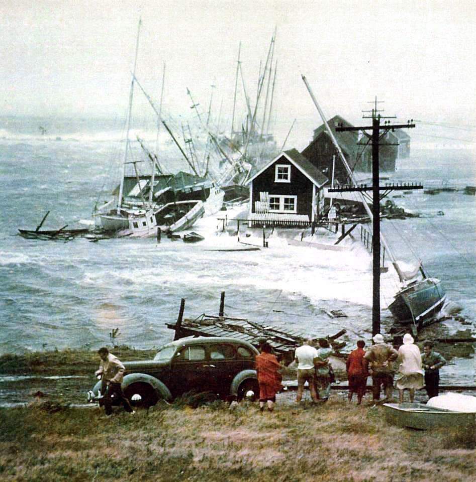
The local historical society put this up on FaceBook. It’s the aftermath of 1954's Hurricane Carol, a storm so destructive its name was retired.
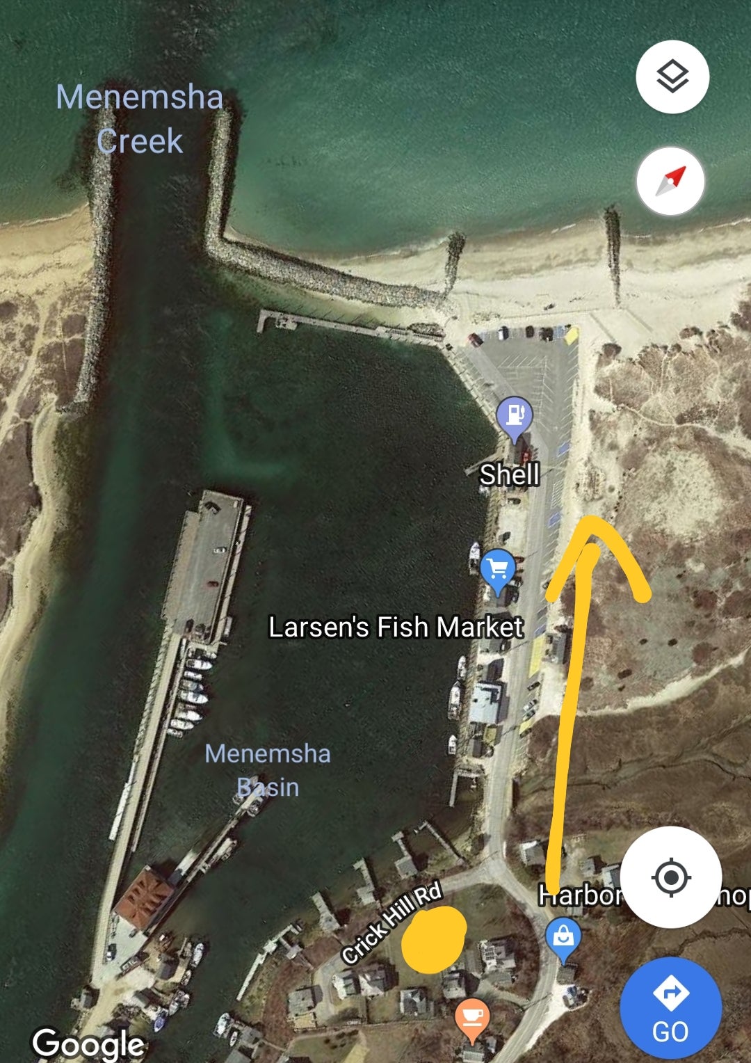
I believe the photographer is standing at the dot here looking out towards the ocean. You can make out waves breaking over the jetty (which is a good 4 feet above normal high tide I might add) off in the distance.
 ranwhenparked
> If only EssExTee could be so grossly incandescent
ranwhenparked
> If only EssExTee could be so grossly incandescent
11/04/2018 at 22:22 |
|
Best guess, ca. 1938 Dodge or Plymouth.
 Rusty Vandura - www.tinyurl.com/keepoppo
> If only EssExTee could be so grossly incandescent
Rusty Vandura - www.tinyurl.com/keepoppo
> If only EssExTee could be so grossly incandescent
11/04/2018 at 22:30 |
|
Wow; I didn’t know the Internet cached satellite images that far back.
|
If only EssExTee could be so grossly incandescent
> Rusty Vandura - www.tinyurl.com/keepoppo
11/04/2018 at 22:37 |
|
Hard y har har
 someassemblyrequired
> If only EssExTee could be so grossly incandescent
someassemblyrequired
> If only EssExTee could be so grossly incandescent
11/04/2018 at 22:38 |
|
1937 Plymouth?
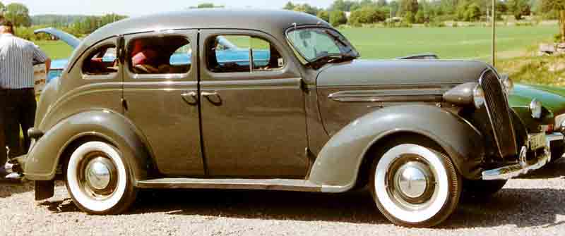
Image from Wikipedia, user Lglswe, CC 3.0
|
Rusty Vandura - www.tinyurl.com/keepoppo
> If only EssExTee could be so grossly incandescent
11/04/2018 at 22:41 |
|
I’m an educator and six or 8 years ago, when I was in charge of producing the high school yearbook where I worked, a lady contacted me and asked me to post pictures of the inside of the old school which had been torn down in the 70s. I said, “They don’t exist.” She said, “Find them on the Internet.”
|
someassemblyrequired
> ranwhenparked
11/04/2018 at 22:42 |
|
Yep, my thoughts as well. Probably a Plymouth due to lack of chrome, and if so it might be a ‘37 given the side strake up front.
 Just Jeepin'
> Rusty Vandura - www.tinyurl.com/keepoppo
Just Jeepin'
> Rusty Vandura - www.tinyurl.com/keepoppo
11/04/2018 at 22:54 |
|
I know you jest, but I’ve been quite surprised at the quantity of mid-20th century aerial photos available online. Unfortunately I can’t find the site I spent a few hours browsing a year ago looking at places I’ve lived, but there are multiple such resources out there.
 CaptDale - is secretly British
> If only EssExTee could be so grossly incandescent
CaptDale - is secretly British
> If only EssExTee could be so grossly incandescent
11/05/2018 at 12:57 |
|
Looks like a Packard