 "Eric @ opposite-lock.com" (theyrerolling)
08/21/2017 at 20:00 ē Filed to: Seattle Cruise 2017, Seattle oppo
 3
3
 8
8
 "Eric @ opposite-lock.com" (theyrerolling)
08/21/2017 at 20:00 ē Filed to: Seattle Cruise 2017, Seattle oppo |  3 3
|  8 8 |
There was a clear winner for the route for our first cruise and we have likely selected the second and third ones as well. Everyone seemed to like the idea of High Bridge Road, which is a very twisty country road. The most open day that everyone mentioned was Saturday, September 9th (09/09), so thatís the day. It looks like weíll be starting around 09:30.
The meet point for the start of the cruise and the end point are currently unknown, but I have tentatively set the start point as the parking lot for the Albertsonís in Clearview (17520 WA-9) and the end point as the center of Snoqualmie. We will also be stopping at Snoqualmie Falls, since itís near the end of this route. If you have a better idea for the start point, please let me know in the comments.
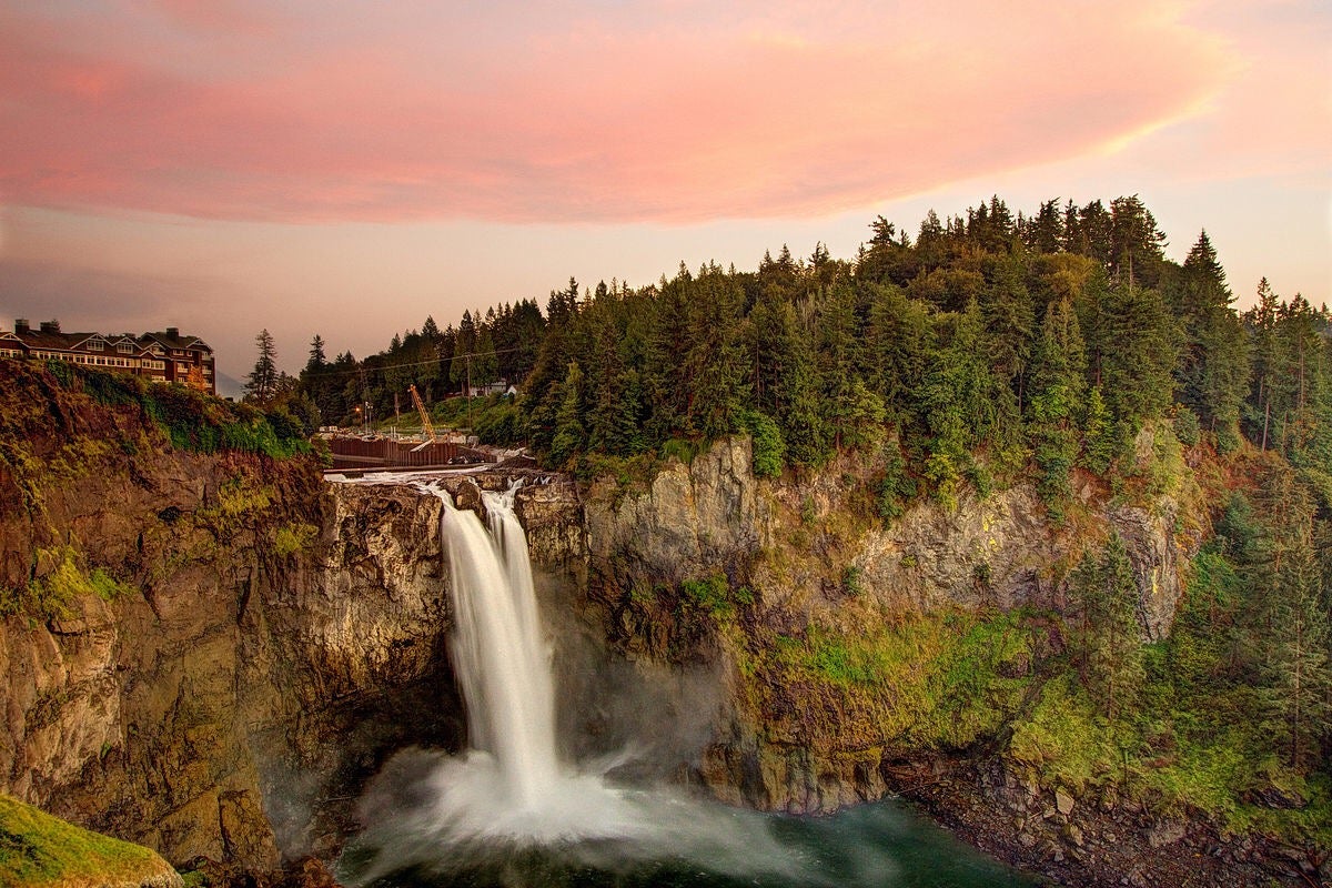
Near the end of the route we will be stopping at Snoqualmie Falls, where anyone that opted out of the upper part of the cruise could meet us before the final leg to lunch.

Snoqualmie Falls, for those unaware of what it looks like.
The final destination (Lunch) is also unknown. Options include almost anywhere from Issaquah through North Bend (but preferably Snoqualmie through North Bend) that is reasonably inexpensive, suitable for a group, good for people of all ages (no over-21 bars, prefer to avoid the casino), and casual (no waitstaff). My first thought is Rio Bravo in North Bend due to the scenic location, outdoor seating, and the fact that summer is fleeting here, but Iíd love to hear all of your thoughts on places to go. This will also act as a final meeting spot for anyone that opted out of the cruise that wants to hang out with us.
Here are the current ideas for routes:
#1 - ~37 miles - High Bridge -> West Snoquamie Valley -> Ames Lake -> Redmond-Fall City -> Fall City-Snoqualmie -> Snoqualmie Falls -> End:
!!! UNKNOWN CONTENT TYPE !!!
This is the simplest route with minimal stopping to regroup, but less curves after High Bridge.
#2 - 50 miles - High Bridge -> Woodinville-Duvall -> Cherry Valley -> Kelly -> Carnation-Duvall -> Carnation Farm -> Ames Lake -> Redmond-Fall City -> Tolt Hill -> Fall City-Carnation -> Fall City-Snoqualmie -> Snoqualmie Falls -> End:
!!! UNKNOWN CONTENT TYPE !!!
This route is the most complex and curvy I could come up with that didnít backtrack (there are limited bridges over the river). There are 3 regroup points - Duvall/Cherry Valley, Chinook Bend, and south of Carnation. This could be an alternate for #3 with a later regroup point past Fall City (unless thatís our ultimate destination).
#3 - 48 miles - High Bridge -> Woodinville-Duvall -> Cherry Valley -> Kelly -> Carnation-Duvall -> Carnation Farm -> Ames Lake -> Redmond-Fall City -> Fall City-Snoqualmie -> Snoqualmie Falls -> End:
!!! UNKNOWN CONTENT TYPE !!!
The same number of bridge crossings, but slightly shorter and more driving on a highway.
Let me know which ones you like best, your order of preference, and if you think something should be added/dropped from a route. If you have any ideas for a final destination or like the one I proposed, please mention that as well.
 Dr. Zoidberg - RIP Oppo
> Eric @ opposite-lock.com
08/21/2017 at 21:01 |
|
If itís below 75 degrees, Iím fairly tempted to bring the longbed instead. And on that note, I should probably take the back.
 Eric @ opposite-lock.com
> Dr. Zoidberg - RIP Oppo
08/21/2017 at 21:04 |
|
Nothing wrong with that!
Here are the map links:
https://trips.furkot.com/ts/pSxOb9
https://trips.furkot.com/ts/f0Sl20
https://trips.furkot.com/ts/k1JC38
 Dr. Zoidberg - RIP Oppo
> Eric @ opposite-lock.com
08/21/2017 at 21:08 |
|
Ah I know High Bridge like the back of a box of Pop Tarts. But let me know if youíre trying to throw Ames Lake in there.
I would think it would from Albertsons, then east on 164th to Broadway, then through to Elliot-High Bridge-W Snoqualmie Valley, 124th to Carnation and south on 203 forever, then either Tolt Hill back to Redmond or stay south all the way to Snoqualmie Parkway?
 Eric @ opposite-lock.com
> Dr. Zoidberg - RIP Oppo
08/21/2017 at 21:13 |
|
The maps are above. I added Cherry Valley and Kelly in #2 & #3 instead of the flatter/smoother parts of W Snoqualmie Valley. They all go through High Bridge, Ames Lake, and stop at Snoqualmie Falls.
 Dr. Zoidberg - RIP Oppo
> Eric @ opposite-lock.com
08/21/2017 at 21:14 |
|
Oh wait now I see the links. Yes letís obey the map
 AestheticsInMotion
> Eric @ opposite-lock.com
08/21/2017 at 22:59 |
|
I like route #1 because once weíre on West Snoqualmie Valley itís basically my daily commute, but in reverse. †#2 looks fun. So does #3 actually... I guess Iíll go 1,2,3 in order of preference?
Only food request-not Mexican please!
 Dogsatemypants
> Eric @ opposite-lock.com
08/21/2017 at 23:40 |
|
Casual food, near Snoqualmie, something something car stuff..... XXXrootbeer comes to mind
 Svart Smart, traded in his Smart
> Eric @ opposite-lock.com
08/22/2017 at 15:43 |
|
Count me in, with a preference for option one over the others (but no preference between options two and three).