 "Green Mountain Car Guy" (williamleedy)
10/23/2015 at 14:10 • Filed to: None
 2
2
 6
6|
"Green Mountain Car Guy" (williamleedy)
10/23/2015 at 14:10 • Filed to: None | 2
| 6 |
Welcome to part 4! If you’ve been following along, congratulations are in order for making it this far! If you want to catch up on the first 3 days of our adventure, please use the links below!
In the last three days we made our way from Vermont down to Washington D.C. and saw all sorts of beautiful cars and aircraft - as well as some great landmarks! Days 4, 5 and 6 are less hectic, so they will be chronicled together below. This is when we were able to really let the Camaro stretch it’s legs. We gave it a pretty good workout in the mountains of Virginia, Tennessee, and North Carolina. Let the fun begin!
Day 4: The Open Road
We made one more stop before leaving DC. This location was recommended to us by some friends who had been following our progress on Facebook. Fortunately we were able to make it work I was glad for that. We arrived at Arlington Cemetery earlier than all of the tour busses, so our walk among the gravesites was serene with low morning sun and cool air. We stopped to visit the Tomb of the Unknown Soldier, which is a very quiet and solemn place. The beautiful marble building stands tall over a large tomb. Inside the building is some history of the tomb and its guardians. Shortly after our arrival we were joined by a group of visiting soldiers who were admiring the location as well. This tomb is guarded 24 hours a day, 7 days a week, 365 days per year. The guards routine is designed around the 21 gun salute. The guard will silently take 21 steps to one side or the other and then pause for 21 seconds before making the 21 step march in the opposite direction - for his entire shift. Hopefully those shoes are comfy! At the end of each shift a ritual is performed so that the next guard can begin their duty of watching over this place. We were there at the right time and were able to witness this change.

Pictured: The guard and the Tomb of the Unknown Soldier.
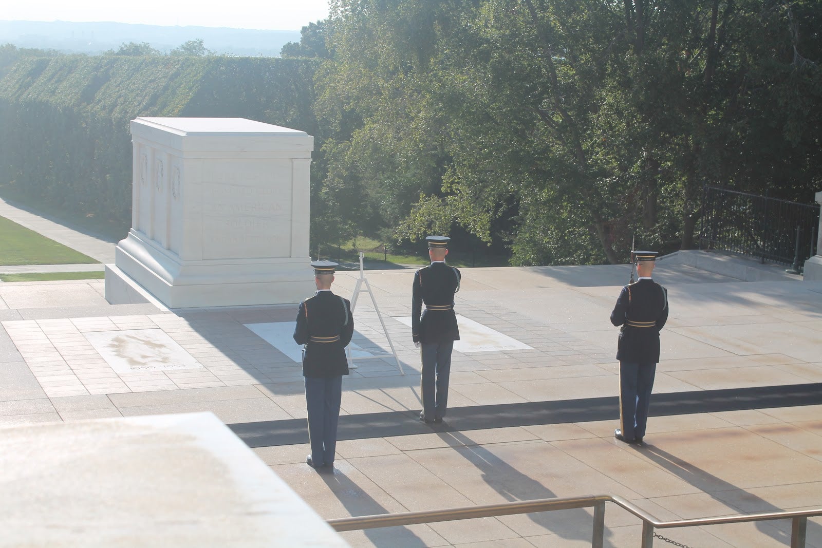
Pictured: The changing of the guard.
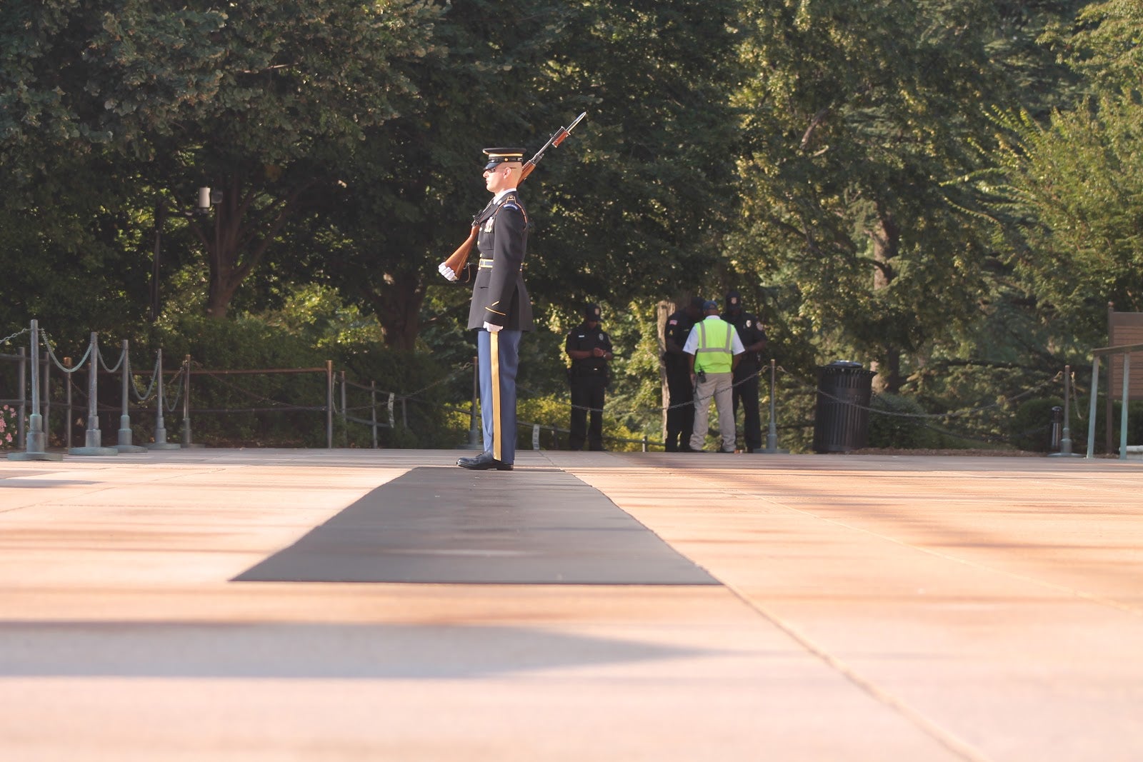
Pictured: The guard begins his post.
Once the ritual was completed, we made our way back down to the car, stopping to take a few pictures of the long lines of seemingly identical tombs, each one marking the final resting place of a soldier. In the quiet morning light this is a beautiful place. Once it’s teeming with tourists, I feel like some of the magic might be lost.
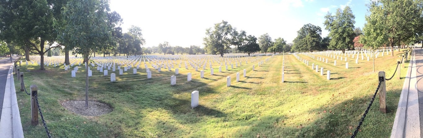
Pictured: Arlington Cemetery.
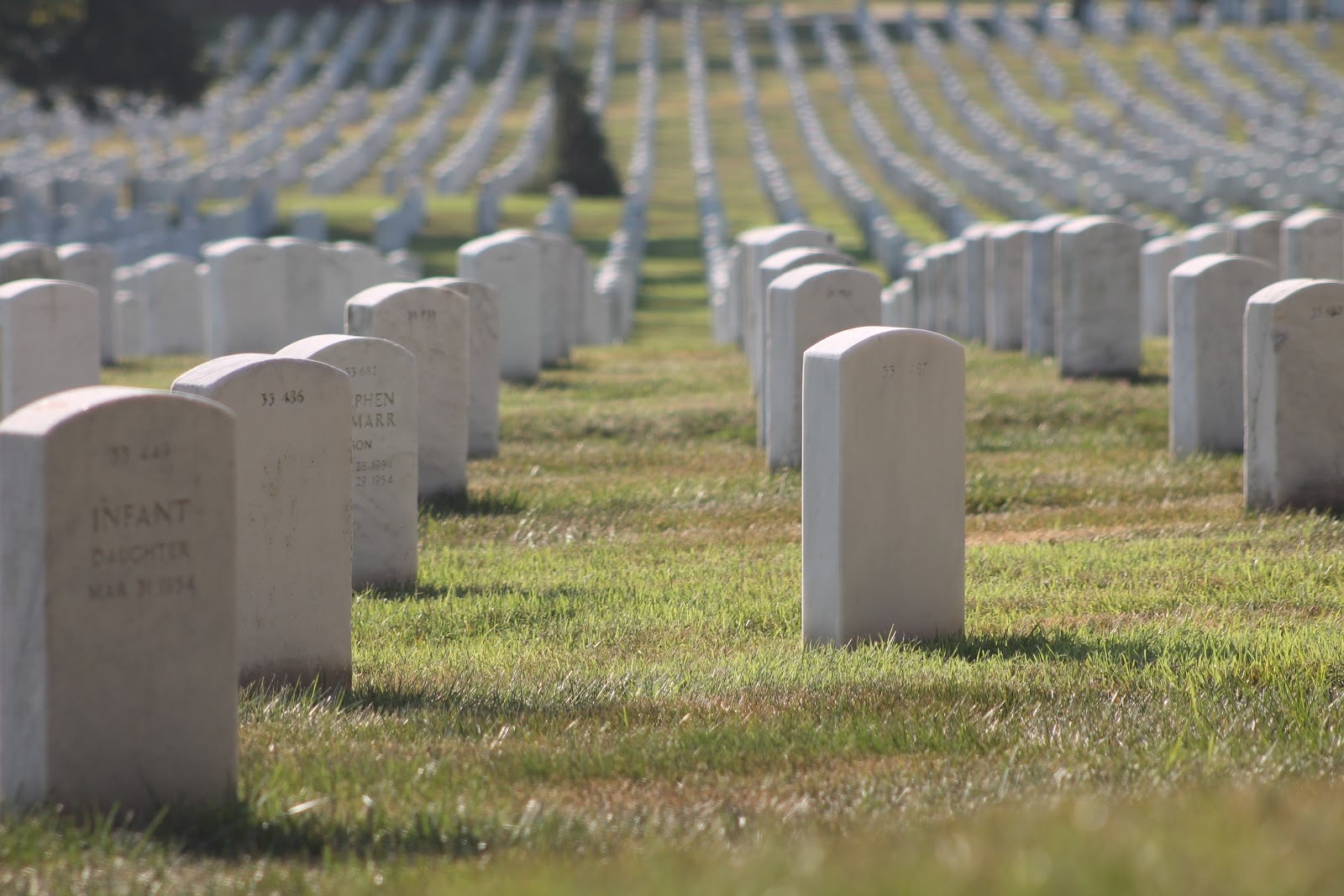
Pictured: Arlington Cemetery.
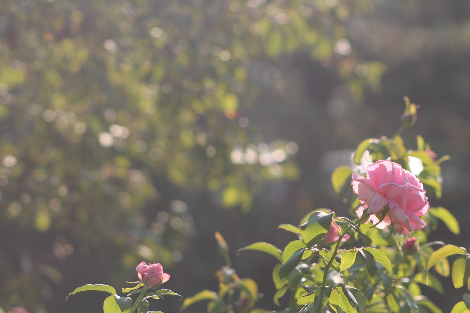
Pictured: A Flower in the cemetery.
We passed by the Pentagon building just long enough to point and say “there it is!” and be on our way. Heading west it felt nice to get out of the cities and see some countryside and decreased traffic for awhile! We pulled off in Front Royal, Virginia to top off the tank. After we got off the highway, a billboard reminded me that there may be one other thing in the area to check out! There’s caverns in them hills. One of the closest was called Skyline Caverns. We decided to check it out! We waited about 20 minutes for the next tour of the cavern to begin. Our guide, Ivan, introduced himself and not only did he know what he was talking about, he was really funny too. He was even very mindful of a claustrophobic elderly woman who had been dragged there by her friend in an effort to fight her fear.
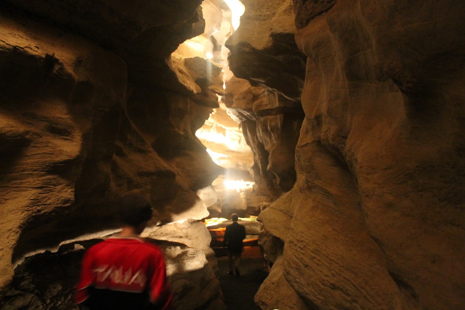
Pictured: Skyline Caverns.
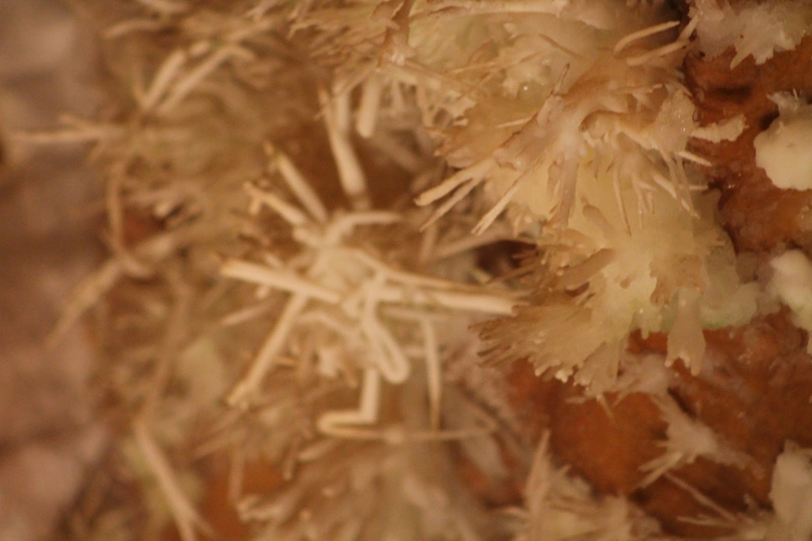
Pictured: Extremely rare anthrodite formation.
Pictured: The roof of the caverns.
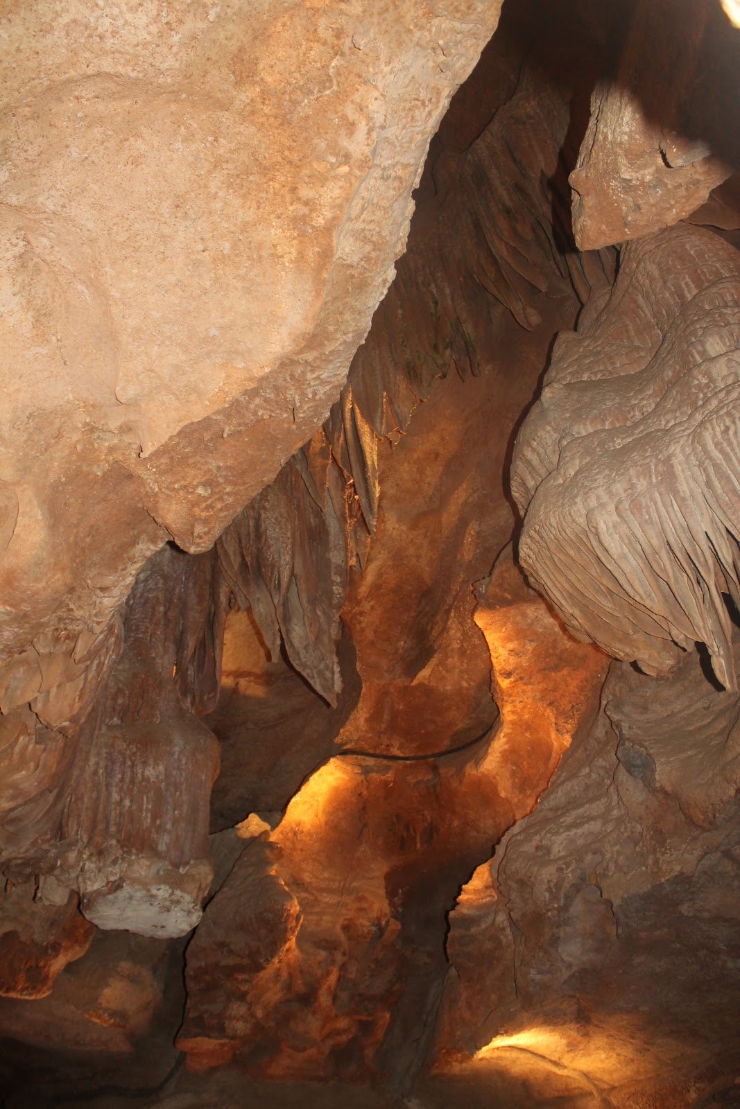
The caverns are very old, formed by water slowly eroding away the softer minerals over thousands of years. Recently, due to a long drought in the area, there was very little, or even no water, where normally there is still a flow. Some tight passes give way to large rooms where the ceilings can be barely visible even with bright lights shining upward. The lights they use, as you’ll see in the pictures below, are colored in order to help reduce algae buildup that can be harmful to the caverns. We were both very glad we had stopped and would suggest you visit if you’re in the area! Exit through the gift shop.
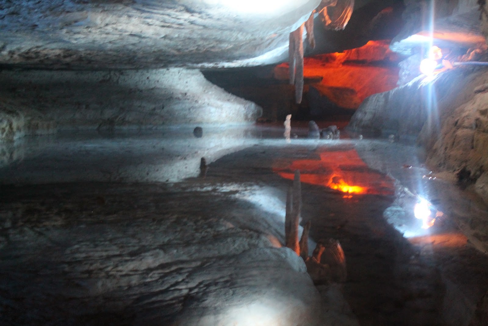
Pictured: One of a couple of pools inside the caverns. It’s about 3” deep.
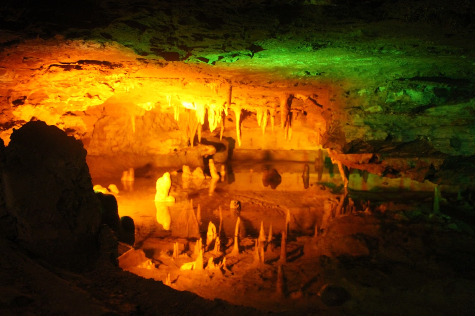
Pictured: Colored lights and lots of stalactites and stalagmites.
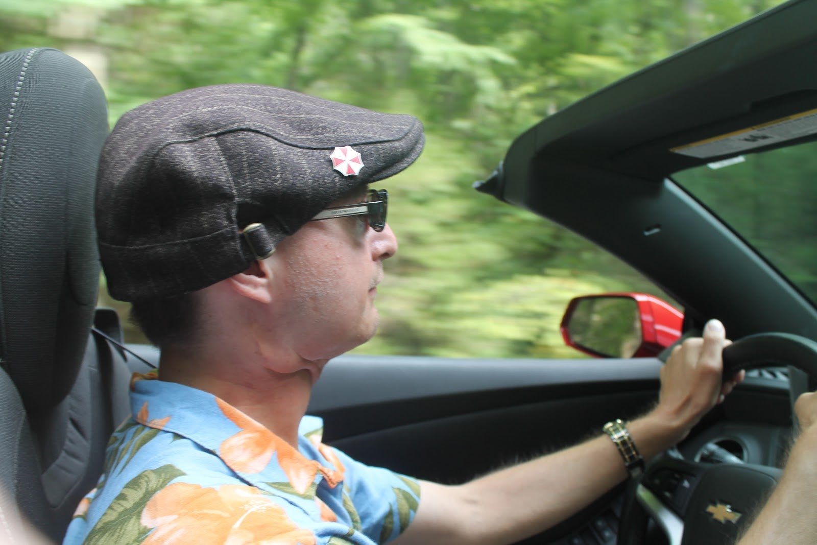
From here the convertible top went back down and we were off onto Skyline Drive - a road that connects to the northern end of the Blue Ridge Parkway and follows the ridge of a mountain range. A $20 fee gets you access to the road and its countless panoramic views to the east and west. A ranger also recommended a waterfall hike that sounded like a pretty reasonable 1.4 mile round trip, called Dark Hollow Falls. It turns out that, as you’re hiking to the waterfall, it’s all smooth and downhill. The return trip however, is a long uphill battle that left us both out of breath by the time we reached the car! The falls are a nice cascade over a couple of levels and is taller than you would expect.
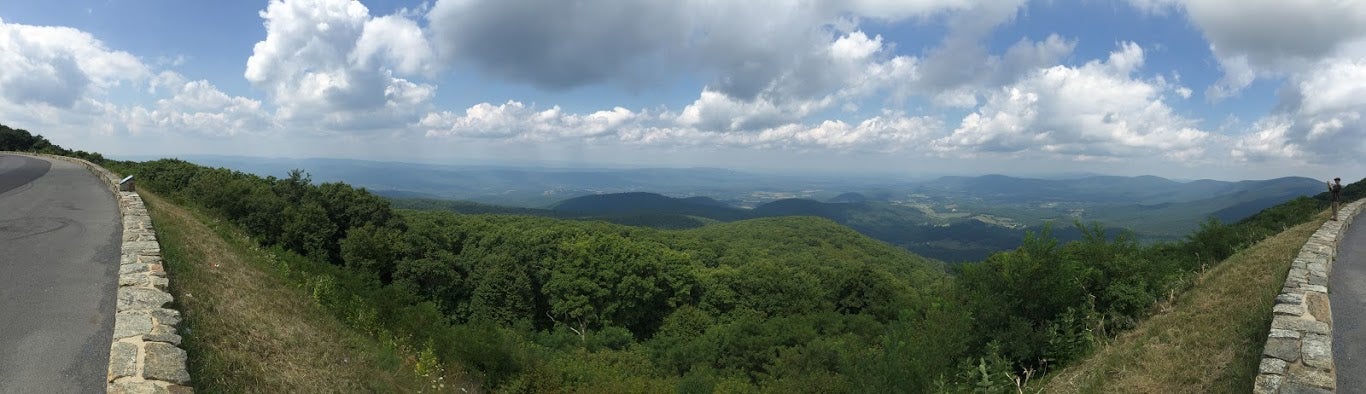
Pictured: One of many incredible views on Skyline Drive.
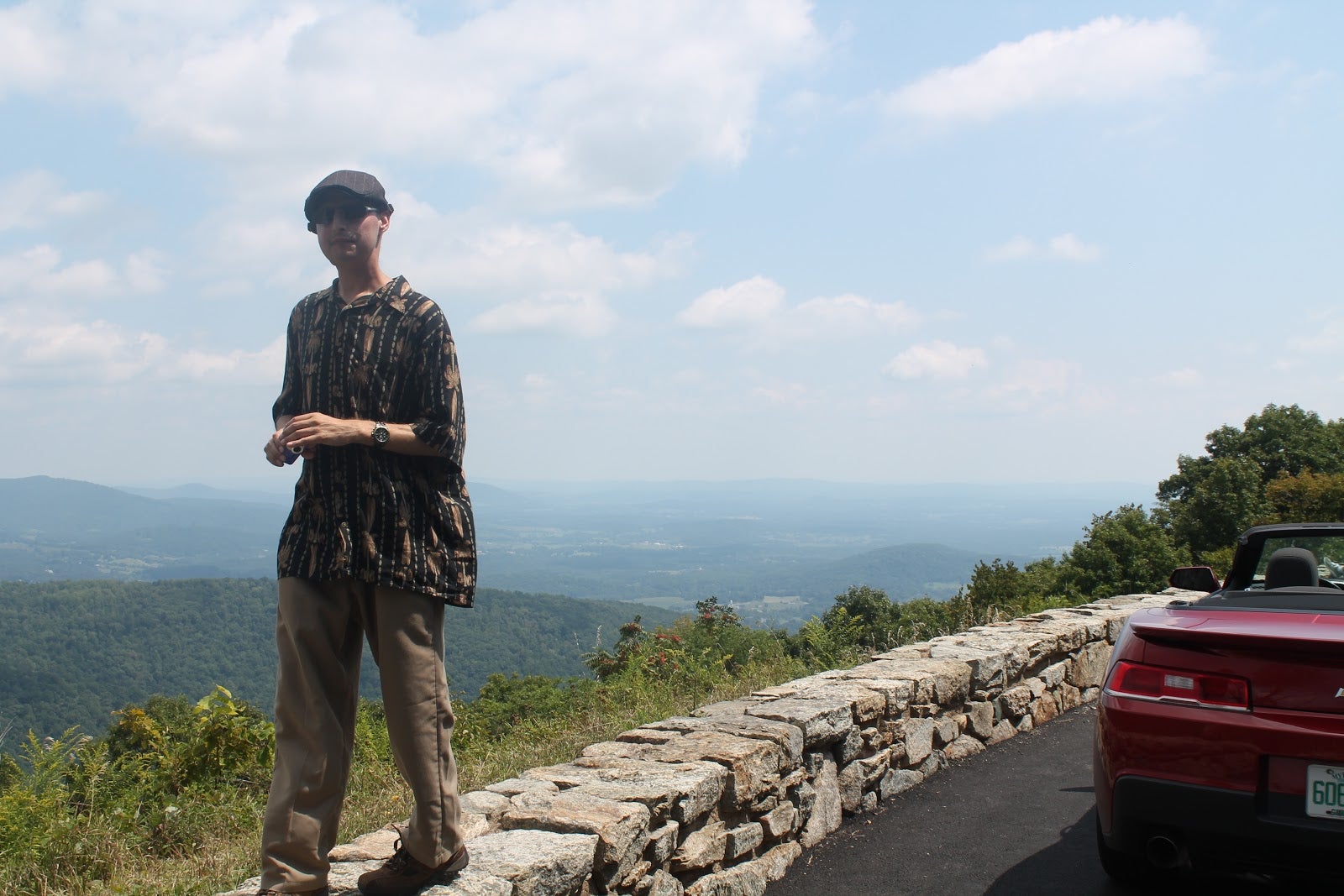
Pictured: Skyline Drive, watch that first step - it’s a doozie.
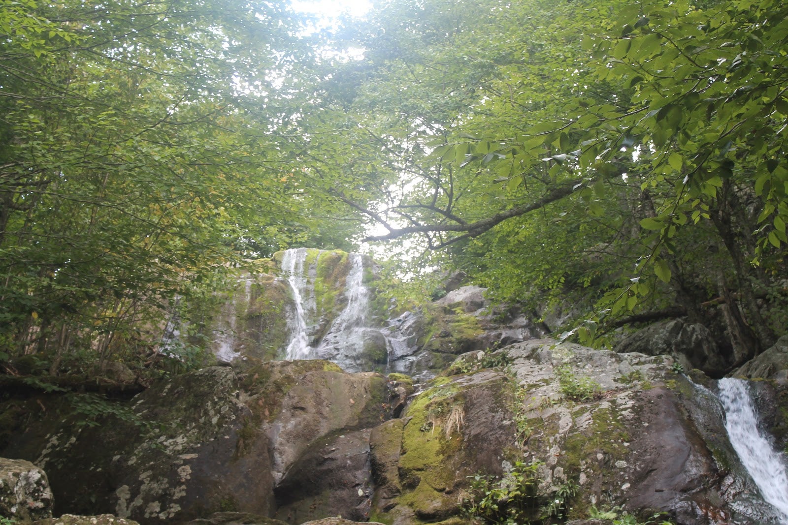
Pictured: Dark Hollow Falls.
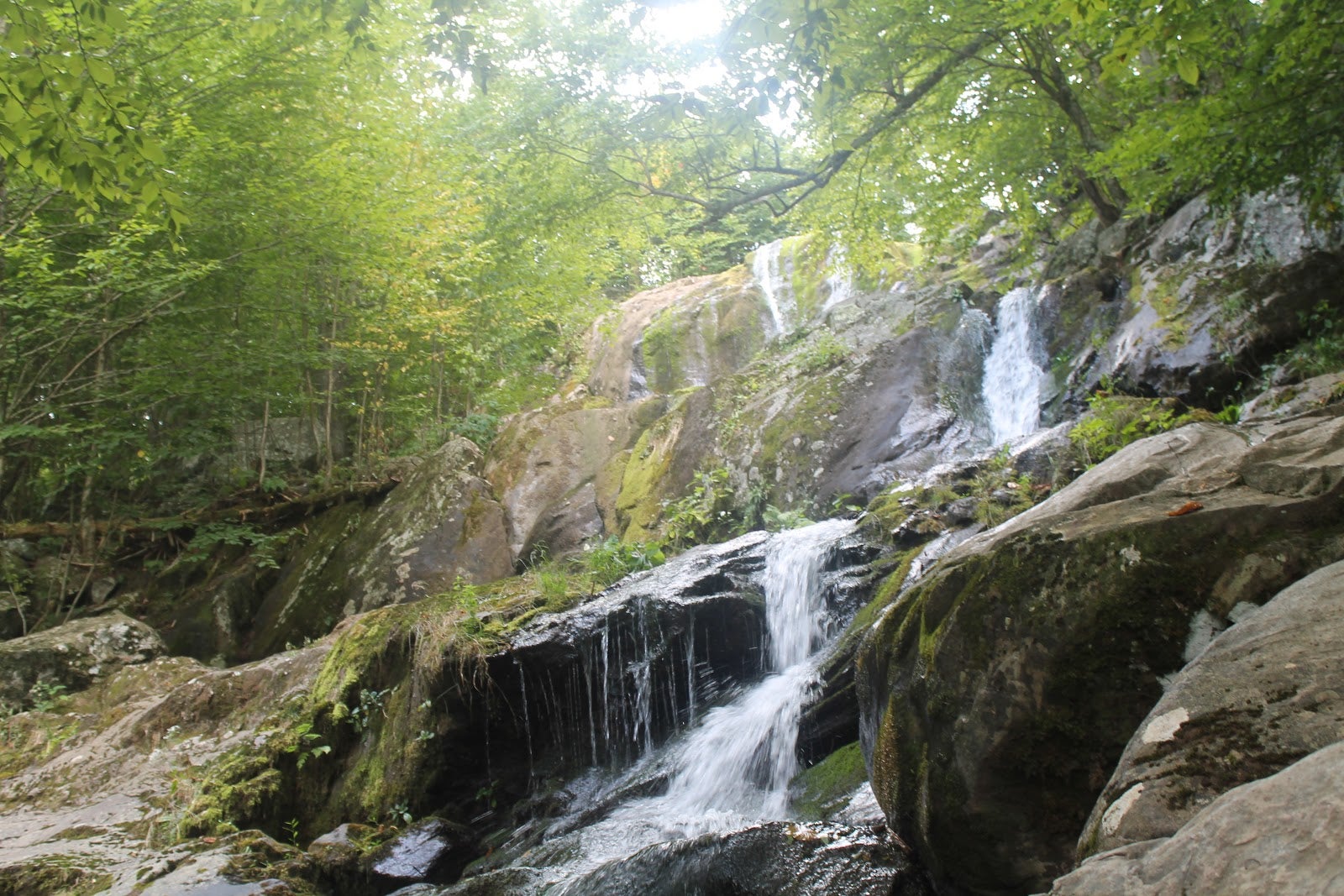
Pictured: Dark Hollow Falls.
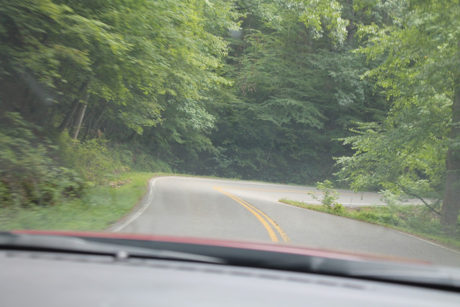
Afterwards it’s further to the south we move, eventually connecting with the Blue Ridge for awhile. As the day was getting long with all the short stops adding up, it was decided we would find the interstate and make our way to the hotel more quickly. The next road for us to exit on was Rt. 56 - a road I had been on with my wife during a previous road trip. The road is narrow with very little shoulder, but is very twisty with a 55mph speed limit. Even pushing the Camaro, the distance between any two corners is short enough that you never really reach that speed. We had one pucker-moment as we rounded a corner to find a log truck parked just at the exit to the curve. As it turned out he had been parked there awhile because a semi truck had got itself stuck in the very tight corners. For us Vermonters, picture a semi truck going up Smuggler’s Notch.
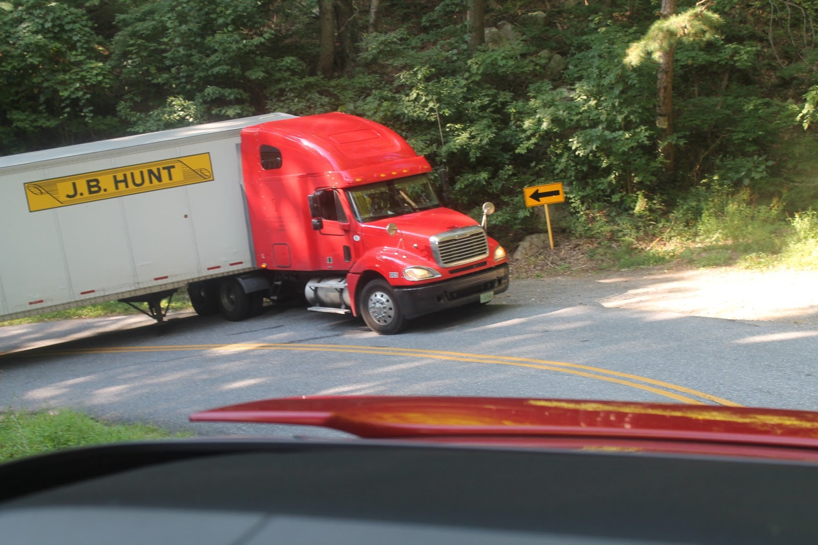
Pictured: The offending truck.
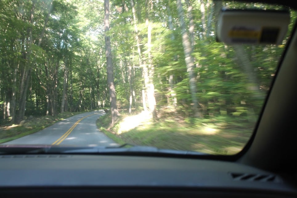
Pictured: Route 56.
Due to the blockade we were forced to turn around and sprint up the road again - what a shame! We met back up with the Blue Ridge and headed further south to try again to make it to the highway. Eventually we successfully found the highway and made our way to our next hotel in Roanoke, VA. We checked in, and before even going up to the room, decided to find some food. On the recommendation of the hotel’s front counter, we went to a small restaurant downtown that was known for its chicken and waffles. Having never eaten that combination before, I went for that while Shawn had some chicken fingers with fries. It arrived quickly, but wasn’t anything special - so we ate our fill and went back to sleep away the night.
Day 5: On Top of Old Smoky (Mountains).
This was another long day - in the end we racked up 722 miles: some easy, some exciting, some not so much. It began with a highway jaunt into Tennessee (a first for both of us). We exited (Tennessee)in time to make our way through Pigeon Forge - which is basically a tourist trap filled to the brim with mini-golf, go-kart tracks, and helicopter tours. Ohh, and there’s Dollywood. However, our real reason for going through there was to get to the next town over, Gatlinburg, to stop at a store called Cooter’s Place. Along with indoor go-karts and a 2nd story mini-golf course, this place is loaded with Dukes of Hazzard memorabilia and souvenirs up to and including a General Lee car. Shawn found lots of things to buy here! The area looked worth exploring further as it’s nestled just at the foot of the Smoky Mountains, but given our tight schedule, that would have to wait.

Pictured: The typical scene through Pigeon Forge, TN.
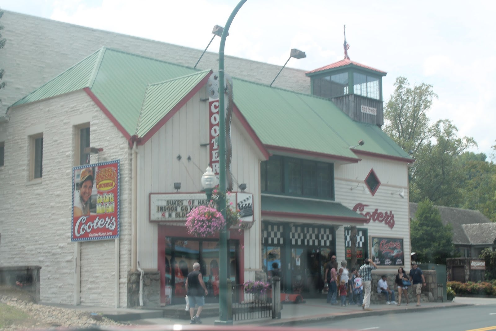
Pictured: Cooter’s Place.
With a fresh load of moonshine, we made a run for the border into North Carolina. We used Rt. 441 over the Smoky Mountains. A slow moving Ford truck meant we were always watching our backs for Roscoe P. Coltraine. The twisty road is beautiful and smooth - giving you great views of the mountains around you, but, it’s very busy with hikers and bikers, so you need to be watching around you pretty closely.
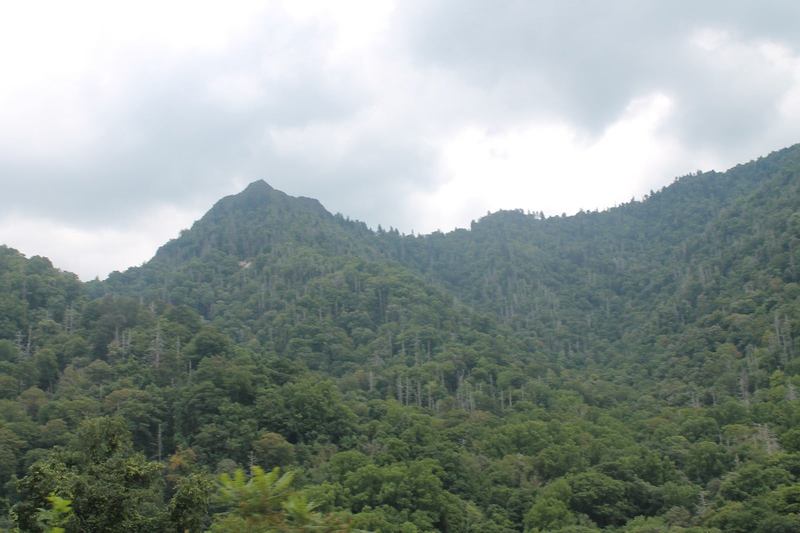
Pictured: The Smoky Mountains.
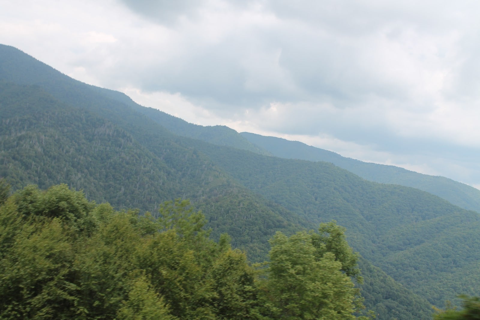
Pictured: The Smoky Mountains.
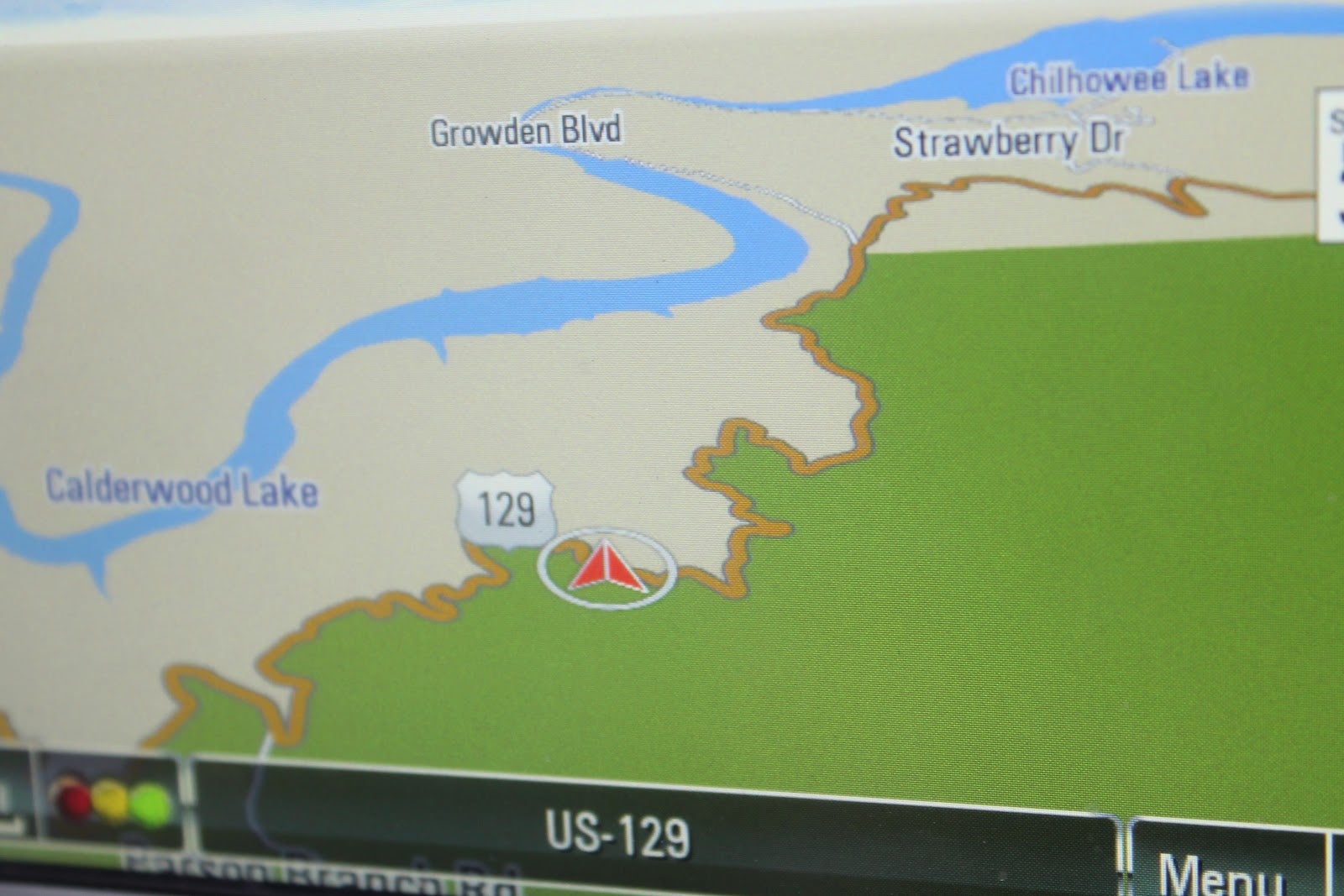
Once we finally made it to the other side mountain we went south again - making our way to a place motorcyclists and car enthusiasts know very well. By some it’s known as Deal’s Gap. By others, it’s called The Tail of the Dragon. It is a road that snakes its way back over the Smoky’s into Tennessee and is on the list of most twisty roads in the world. Over the course of its 11 mile pass to the other side of the mountain, you are treated to 318 corners. The road is not wide and there is no real room for error. Despite being very wide, the Camaro did remarkably well on its all-season tires - even the automatic transmission kept up with our demands. For the enthusiast, this road is not to be taken lightly - slow moving cars or motorcycles could be just around that next corner. We came across a Harley that had lost control and crashed - its driver was taken away to the hospital. I drove the first leg of the road, having a blast shuffling the Camaro through the corners and keeping pace with a couple on a sportbike. Once we came across the dumped motorcycle, we slowed down and turned around. Shawn took the wheel from there for the blast back to the beginning.

Pictured: The beginning of the tail.
Pictured: The route ahead.
Pictured: Here we go!
Pictured: Shawn’s only time behind the wheel.
We stopped at the shops located near the entrance to the road, giving the engine and brakes time to cool back down. After topping off the tank again I settled back into the driver’s seat. We set the navigation for our hotel in Tifton, Georgia and made our way south with the flow of traffic. We stopped once before reaching our destination for dinner at Sonic. Neither of us had ever been to one and for fast food, it was really quite good. Although, I’m not sure the outdoor ordering/serving would be much fun in Vermont winters. We made it to Tifton without incident and found ourselves in a pretty decent hotel room for the night.
Day 6: Into the Crazy State.
We awoke in Georgia with only a couple more days to go. On this day, however, was only one stop. The Kennedy Space Center, which just happened to be a few hundred miles away. The roads between us the KSC were all straight and flat. That was, of course, except for the occasional “left a bit” or “right a bit” sections that typically house a toll booth (which we learned is not compatible with EZ-Pass), or the hills that are artificially created when one road passes over another. Ominous clouds prompted me to pull over to put the top up and a couple of bursts of heavy rain meant we didn’t regret that decision.
When we finally arrived at Kennedy later in the afternoon it was still raining a little bit, so, for the first time, our umbrellas became useful. After walking through a couple of surprisingly cheesey exhibits, we walked around the rocket garden (guess what’s on display there!?) and eventually made our way to the pickup point for the KSC facility bus tour.
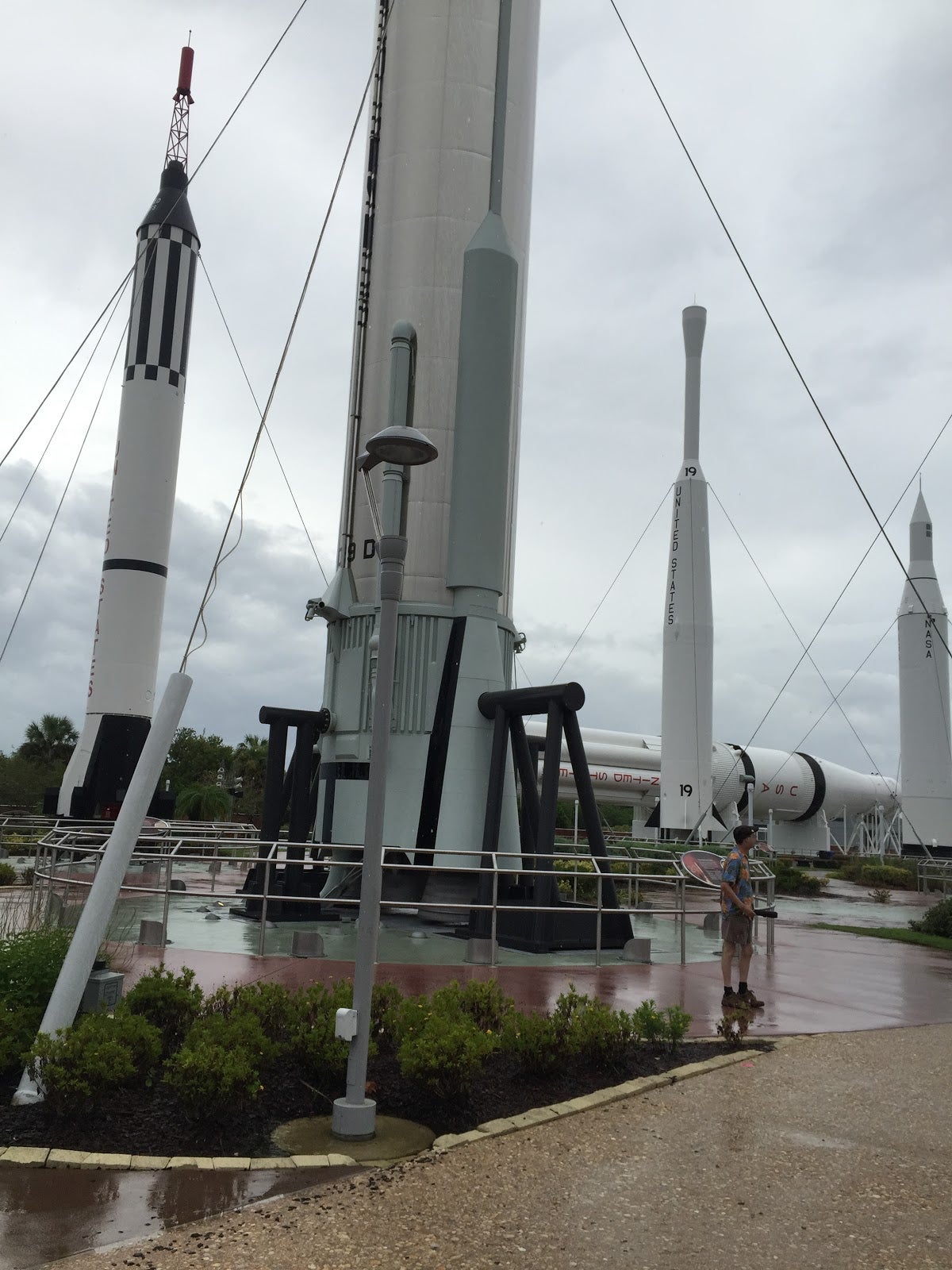
Pictured: The rocket garden.
On the tour, narrated for us by a friendly Russian driver, you get close to a couple of launch pads complete with lightning rods and huge tanks of Hydrogen fuel. We passed by a couple of SpaceX buildings, which belong to a private space exploration company owned by billionaire Elon Musk who is also the CEO of Tesla Motors. The driver also stopped briefly when we came up to a crawler transporter and the gravel roads it trundles along for quick photo opportunity.

Pictured: Shuttle crawler.
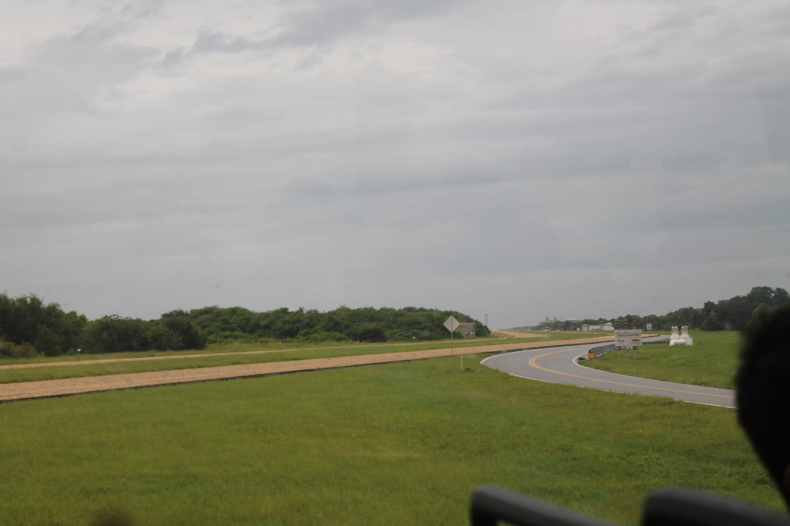
Pictured: The gravel road that leads to each of the launch sites.
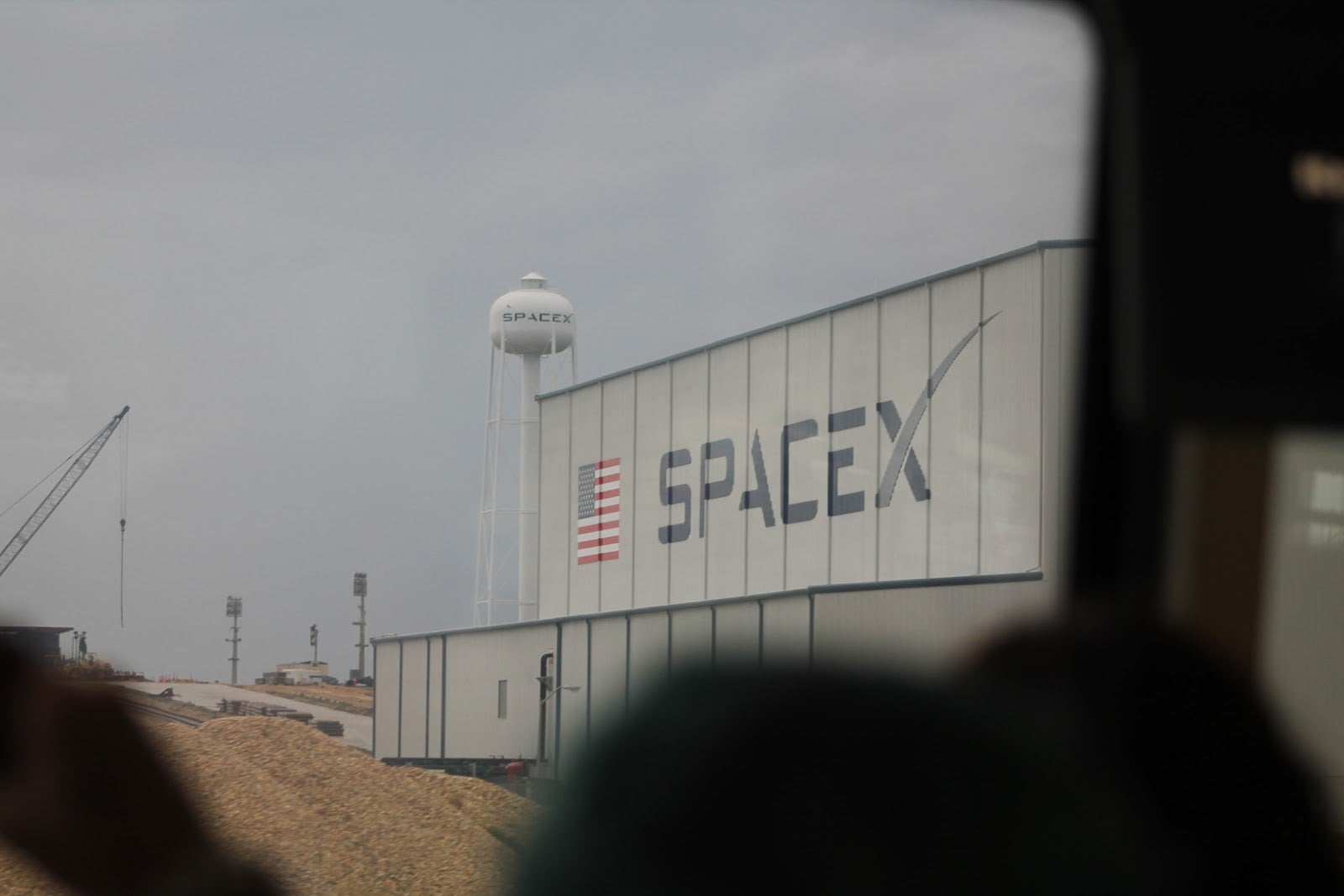
Pictured: SpaceX building.
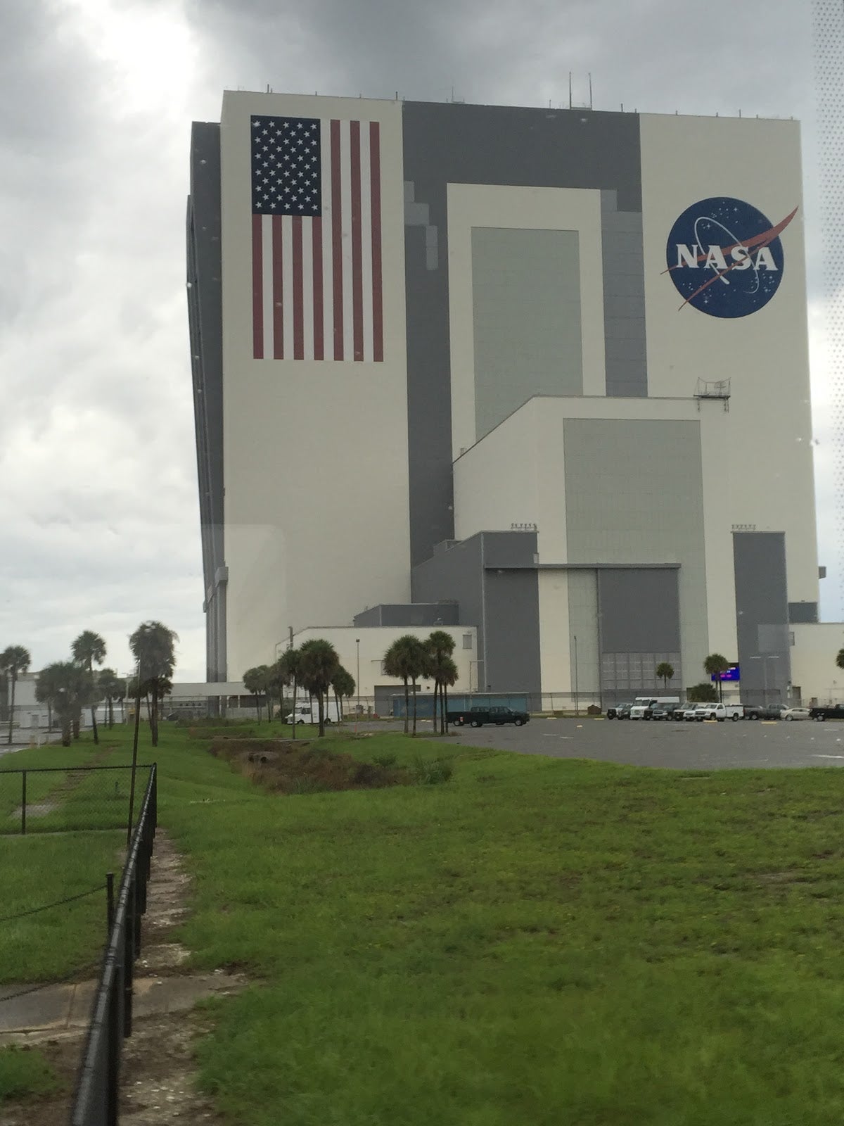
From its sheer size, the Vehicle Assembly Building (VAB) is visible from almost everywhere. This is where the rockets are assembled and placed on the crawlers before making their way to the launch pad. In volume, it’s one of the largest buildings in the world and with nothing around it but flat ground, it’s very hard to get a feel for just how large the building is. For scale, one can look at the office trailers littered around the base - or the fact that the American flag on the side of the building is 21 stories tall!
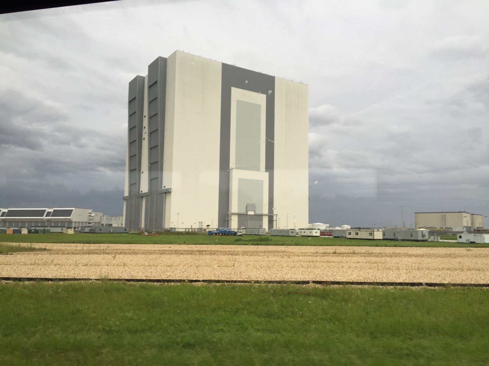
Pictured: The Vehicle Assembly Building.
We also stopped at a building housing an actual, unused, Saturn V rocket. It was laying on its side so that you could walk the length of it. The massive boosters and their fuel tank - required to launch the rocket out of the atmosphere - took up nearly half of the entire rocket. Walking along to the top, it looks like about 90% is the 3 stages of engines required to propel it, 5% is the antenna array at the nose, and the remaining 5% is the tiny and cramped quarters that hold the precious cargo!
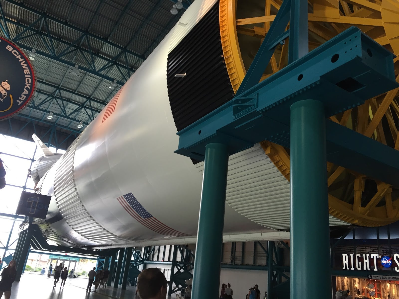
Pictured: Saturn V, Stage 1.
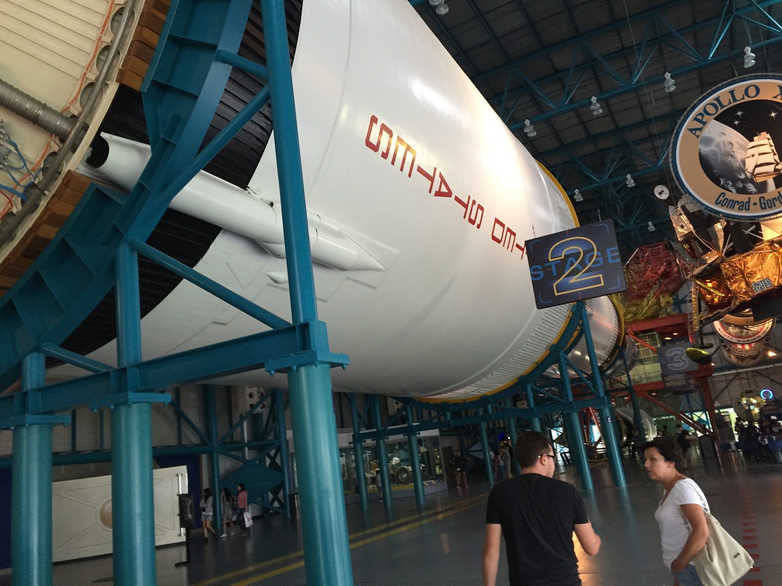
Pictured: Saturn V, Stage 2.
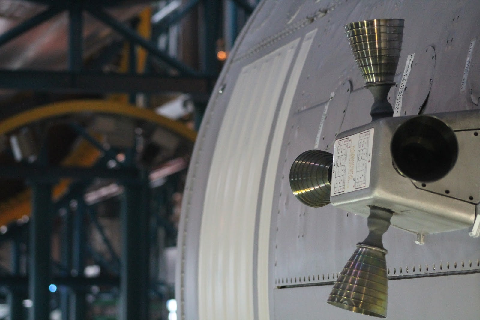
Pictured: Saturn V, Stage 3 boosters.
The bus tour concluded back at the visitor center, where it dropped us off at the entrance to the Atlantis shuttle building. Inside, two large theaters each displayed a different movie following the progression of the Shuttle program. These videos were meant to create drama and excitement. Just as the 2nd video finished, a door rose behind the screen - then the lights went off and all you saw was the huge room beyond with the Atlantis space shuttle pointed right at you. It was one of the highlights of the day and filled us (or me at least) with lots of American pride! The room also housed a host of displays and information about the shuttle and its missions. Unlike the Enterprise shuttle at the Intrepid museum, this one was mounted at an angle with its cargo bay doors open and the crane arm extended. From this viewpoint, you could see just how much of the shuttle was devoted to cargo space and what little remains for the astronauts. The shuttles were awesome to see and make you hope for their resurrection! As an aside, how many people have seen two shuttles within a few days? I bet that’s a surprisingly short list!
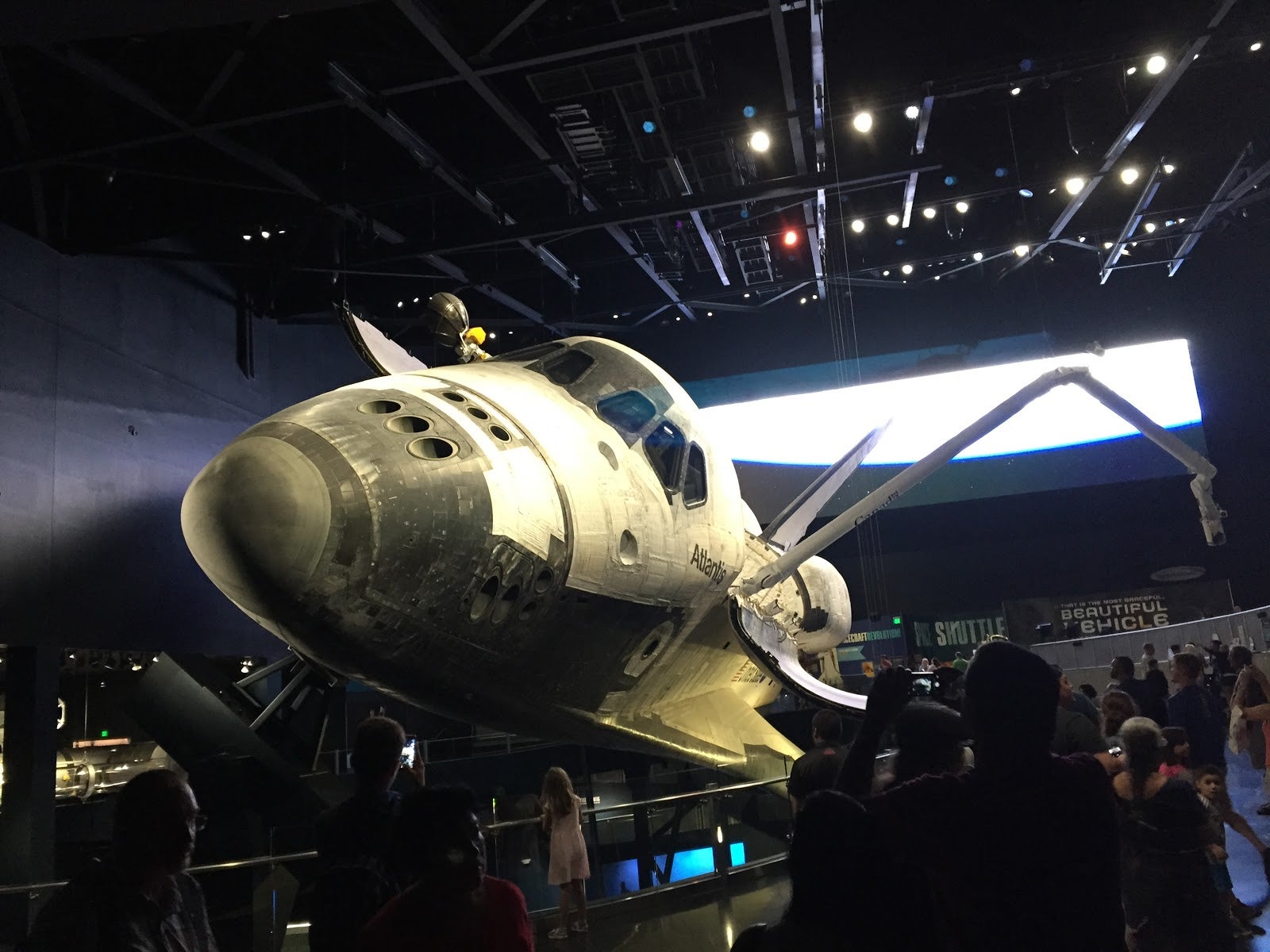
Pictured: Atlantis Shuttle.
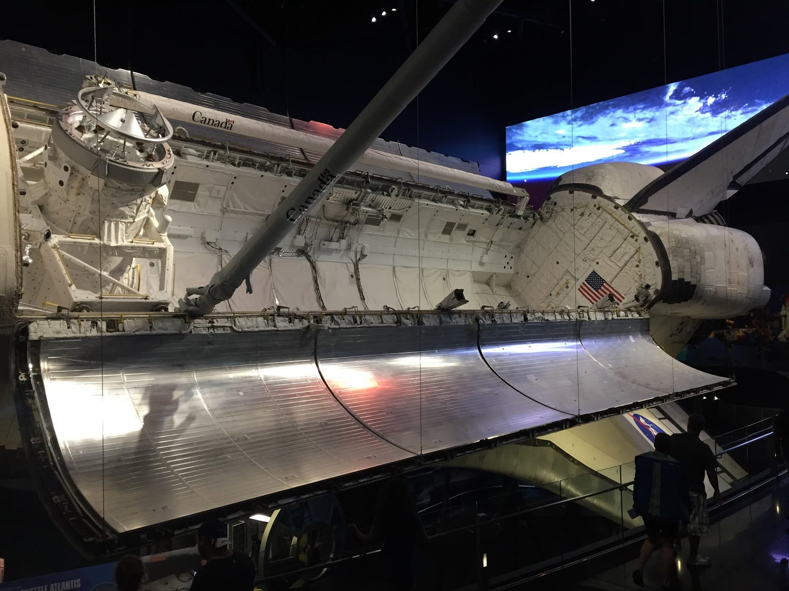
Pictured: Atlantis Shuttle cargo bay.
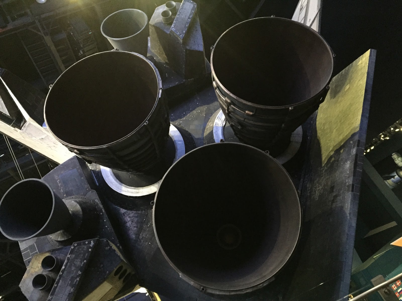
Pictured: Atlantis space shuttle business end.
Exit through the gift shop.
We ended the day with a trip to Arby’s for dinner and then spent the night at a Ramada in nearby Titusville.
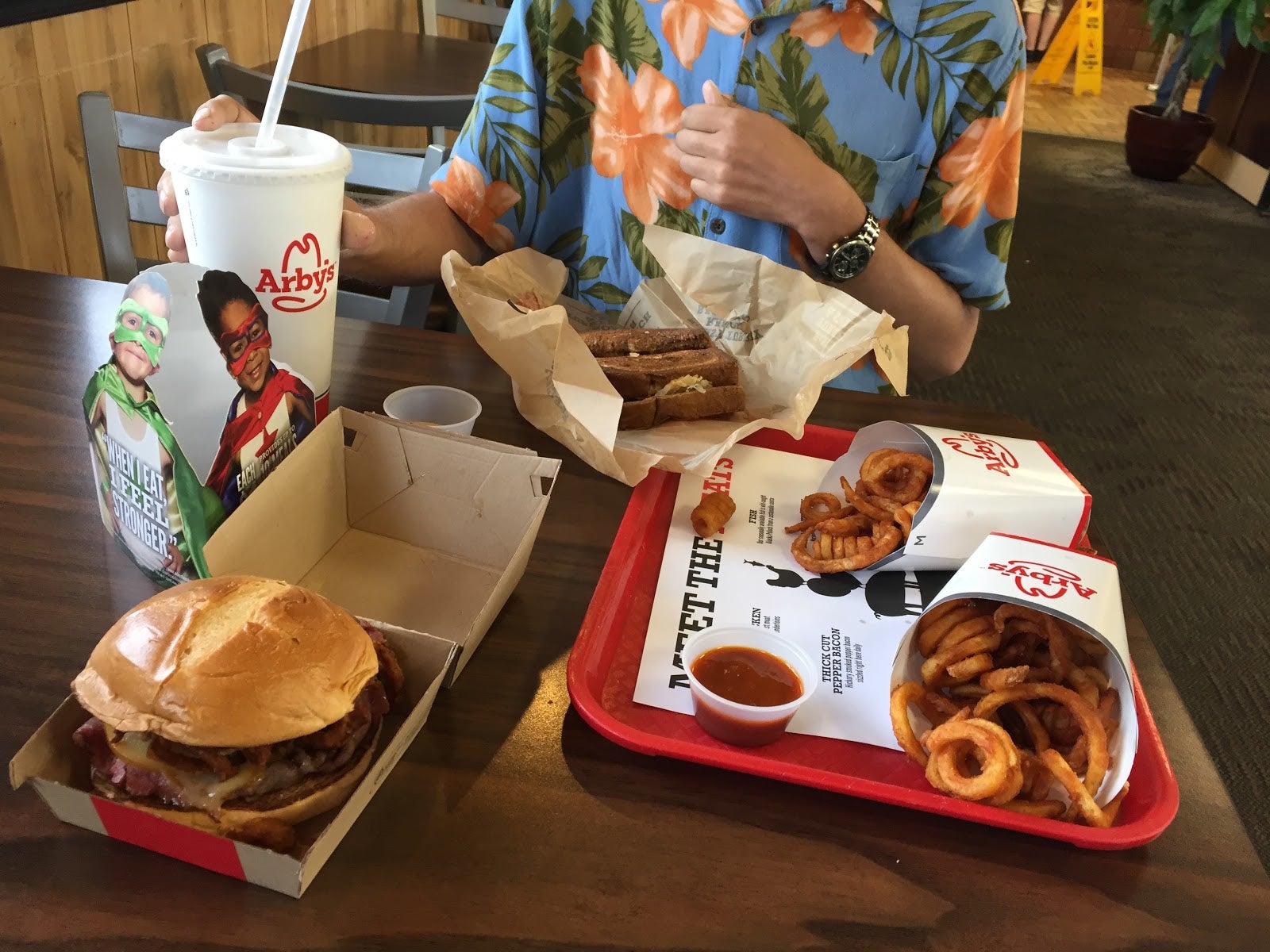
Pictured: Arby’s - they have the meat.
Click below for the 5th and final part of this story and our journey! Thank you.
Click here for Day 4’s photos.
Click here for Day 5’s photos.
!!!error: Indecipherable SUB-paragraph formatting!!! .
 Punk_Girl_98
> Green Mountain Car Guy
Punk_Girl_98
> Green Mountain Car Guy
10/23/2015 at 14:17 |
|
Wow, what an adventure!
 bob and john
> Green Mountain Car Guy
bob and john
> Green Mountain Car Guy
10/23/2015 at 14:37 |
|
this is one hell of a trip. best wishes to your buddy.
|
Green Mountain Car Guy
> bob and john
10/23/2015 at 14:46 |
|
Thank you very much - we had an awesome time! We’re looking forward to a second trip (which may include two more people to make it even more hectic!)
 Party-vi
> Green Mountain Car Guy
Party-vi
> Green Mountain Car Guy
10/23/2015 at 14:50 |
|

A rose. The kind that Mary Anna Custis Lee grew at Arlington House before the State seized the property for non-payment of taxes and the US Government purchased it at auction, after which Arlington National Cemetery was established in Mary Anna’s gardens a middle finger to Robert E. Lee for siding with the south. His son, George Washington Custis Lee, took the government to court over illegal seizure of Arlington House/land, won, and had them buy the estate back from him for $150,000 ($3M today).
|
Green Mountain Car Guy
> Party-vi
10/23/2015 at 14:54 |
|

|
Green Mountain Car Guy
> Punk_Girl_98
10/23/2015 at 14:56 |
|
It was an amazing time - and we still had 2 more days after this!!